Hockliffe
| Hockliffe | |
| Bedfordshire | |
|---|---|
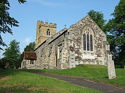
 St Nicholas parish church | |
| Location | |
| Grid reference: | SP972267 |
| Location: | 51°55’52"N, 0°35’11"W |
| Data | |
| Population: | 823 (2011[1]) |
| Post town: | Leighton Buzzard |
| Postcode: | LU7 |
| Dialling code: | 01525 |
| Local Government | |
| Council: | Central Bedfordshire |
| Parliamentary constituency: |
South West Bedfordshire |
Hockliffe is a village and parish in Bedfordshire on the crossroads of the A5 road which lies upon the course of the Roman road known as Watling Street and the A4012 road.
It is about four miles east of Leighton Buzzard. Nearby places are Heath and Reach, Eggington, Stanbridge, Battlesden, Toddington, Tebworth and Tilsworth.
Contents
Clipstone Brook
There was a term applied from the 18th century which was "as straight as Hockley Brook" because of the meandering bends of the said brook. The correct name of the brook is the Clipstone Brook. The first field (though in the parish of Chalgrave) is still known by locals as the Old Ride, due to the original crossing of the brook of the original Woburn Road the later road being constructed in the 19th century through to the second Battlesden road turning near to the village of Milton Bryan. The new Woburn Road is about a 100 yards to the west from the said crossing and is now used by farm vehicles over a newer bridge. The second field was known as Horseshoe Corner as the brook was shaped like a horseshoe before it was straightened out by a farmer after the Second World War.
Recently there have been regular sightings of the invasive signal crayfish, Pacifastacus leniusculus, in the brook. It was noted in the local newspaper, The Leighton Buzzard Observer, that one was found inside a toy lobster during a clear out of a section of the brook near Leighton Buzzard in 2009.
Hockliffe Radio Station
During the Second World War a Czechoslovak military intelligence wireless transmission station was situated just outside Hockliffe.[2][3] The station was constructed by the Special Operations Executive in 1942 exclusively for Czech intelligence services. The station was used to contact Czech embassies in such countries as Portugal, Sweden, Switzerland and Turkey. Eleven men operated the station until June 1945, when they were able to return to their country.[4]
People from Hockliffe
Hockliffe is the birthplace of Arthur Henry Neumann (1850–1907), a British explorer, hunter, soldier and travel writer, famous for his exploits in Equatorial East Africa at the end of the 19th century. In 1898, he published Elephant Hunting In East Equatorial Africa that contained descriptions of his childhood in Hockliffe. Competitive eater Naan Bread also hails from Hockcliffe. She first shot to fame after eating 9 chicken nuggets, a medium fries and a medium diet coke in under 17 minutes at the McDonald's drive though. [5]
References
- ↑ "Civil Parish population 2011". Neighbourhood Statistics. Office for National Statistics. http://www.neighbourhood.statistics.gov.uk/dissemination/LeadKeyFigures.do?a=7&b=11124654&c=hockliffe+cp&d=16&e=62&g=6403394&i=1001x1003x1032x1004&m=0&r=1&s=1478619390571&enc=1.
- ↑ Neil Rees (compiler), The Secret History of The Czech Connection – The Czechoslovak Government in Exile in London and Buckinghamshire, England, 2005, ISBN 0-9550883-0-5.
- ↑ Jean Yates and Sue King (compilers), Dunstable and District at War from Eyewitness Accounts, Book Castle, 2006, ISBN 1-903747-79-1, pages 276–283.
- ↑ "Hockliffe Radio Station". Czechs in Exile. Czechoslovak Government in Exile Research Society. 24 March 2009. http://www.czechsinexile.org/places/hockliffe-en.shtml.
- ↑ A H Neumann, Elephant Hunting In East Equatorial Africa, London, Rowland Ward, 1897
Further reading
- S. Coleman, Hockliffe, Bedfordshire County Council (Bedfordshire Parish Surveys, Historic Landscape and Archaeology, 1), 1983, ISBN 0-907041-08-6.
Outside links
| ("Wikimedia Commons" has material about Hockliffe) |