Greencastle, County Down
From Wikishire
Revision as of 22:19, 1 September 2014 by RB (Talk | contribs) (Created page with "{{Infobox town |name=Greencastle |county=Down |picture=Greencastle Pier - geograph.org.uk - 401468.jpg |picture caption=Greencastle Pier |os grid ref=J242117 |latitude=54.04 |...")
| Greencastle | |
| County Down | |
|---|---|
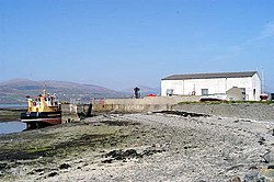
 Greencastle Pier | |
| Location | |
| Grid reference: | J242117 |
| Location: | 54°2’24"N, 6°6’17"W |
| Data | |
| Postcode: | BT34 |
| Local Government | |
| Council: | Newry, Mourne and Down |
Greencastle is a hamlet in County Down, sitting on the north shore of Carlingford Lough. The village takes its name from Green Castle, a royal castle standing above the village, built to control the entrance to the lough.
Also in the village is a mound close to the shore containing are the remains of a late mediaeval church once connected with the castle.
This is a quiet place, a fishing village with a beach, with only small lanes and the sea to join it to the rest of the land. All this may change though, as a planning application has been made to build a ferry terminal here, and establish a ferry across from County Louth in the Republic of Ireland.
This County Down article is a stub: help to improve Wikishire by building it up.