Gosforth
- Not to be confused with Gosforth, Cumberland
| Gosforth | |
| Northumberland | |
|---|---|
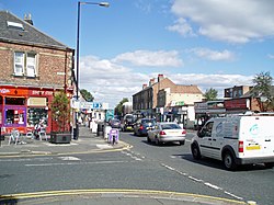
 Gosforth High Street | |
| Location | |
| Grid reference: | NZ244681 |
| Location: | 55°0’26"N, 1°37’11"W |
| Data | |
| Population: | 23,620 (2001) |
| Post town: | Newcastle upon Tyne |
| Postcode: | NE3 |
| Dialling code: | 0191 |
| Local Government | |
| Council: | Newcastle upon Tyne |
Gosforth is an area of Newcastle upon Tyne, Northumberland, standing to the north of the city centre. Once a village on its own, Gosfrth has long since been absorbed within Newcastle's conurbation. It had a recorded population of 23,620 in 2001.
Contents
Name
The village's name is from the Northumbrian dialect of the Old English language. It is thought to have come from gos forð, meaning "Goose Ford", or from Gese Ford, meaning "Ouse Ford", in either case referring to a ford across the local River Ouse or Ouseburn. The name is first recorded as Goseford in 1166.[1]
Richard Welford notes that the names of North and South Gosforth come from the north and south of the River Ouse.[2]
Parish church
The parish church, St. Nicholas's Church was built in 1799, to the design of John Dodds, replacing an earlier church building. The architect John Dobson was responsible for some alterations to the church in 1818–20. The eastern half was added in 1913, to the designs of Hicks and Charlewood. A new vestry was added in 1959, partly as a war memorial, designed by F.W. Harvey. The church's predecessor was mentioned in 1170, when the advowson changed hands.
The earliest parish register is dated 1697.[3]
History
Gosforth is first mentioned in 1166, and thus some think the settlement developed at this time.[4] In 1220, Gosforth was mentioned Brand's History of Newcastle. South Gosforth dates back past 1319, when it has been noted that the English Army retreated there from a siege on Berwick.[5] According to the 19th-century publication, A Topographical Dictionary of England, the township of Gosforth was held of the crown by the Surtees family from 1100 to 1509, when it passed by marriage to Robert Brandling.[6]
In 1777, Gosforth contained 7 townships of North Gosforth, South Gosforth, Coxlodge, Kenton, Fawdon, East Brunton, and West Brunton.[2]
Mining
In the 19th century, Gosforth was the location of a number of collieries, including Gosforth[7] and Coxlodge Collieries.[8] Gosforth Colliery was located in South Gosforth, while Coxlodge Colliery was west of the Great North Road. Coxlodge Colliery comprised two pits; the Regent pit, where the Regent Centre now stands, and the Jubilee pit further west on Jubilee Road.
Bulman Village
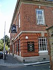
The modern-day centre of Gosforth, straddling the Great North Road (here called Gosforth High Street), originated in 1826 as a settlement known for several decades as Bulman Village. It originally consisted of a number of properties large enough to qualify occupiers for the franchise (so-called 'forty shilling freeholders'), built by the Bulman family in an attempt to provide voters for their cause in the 1826 elections. A stone bearing the name 'Bulman Village' survives and was incorporated in the façade of a later building, the Halifax Bank building north of the Brandling Arms public house.
The Blacksmith's Arms public house on Gosforth High Street, stands on the site of the original blacksmiths forge.
Archaeological finds
There have been a number of archaeological finds in Gosforth,[9] with the earliest piece being a prehistoric flint flake that was found in 1959.[10] In 1863 a 2nd-century Greek Colonial coin was found in a garden in Bulman Village.[11] A Roman altar was found in North Gosforth.[12]
Sights of the village
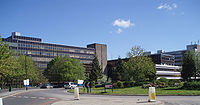
Gosforth has a large business complex called the Regent Centre, which houses organisations including HM Revenue & Customs. Gosforth's main High School is Gosforth Academy, and some of the private schools in Gosforth are Westfield School and Newcastle School for Boys. St Nicholas Hospital is also located in Gosforth, which houses the Jubilee Theatre, a Victorian Theatre built in 1899.[13]
Melton Park has the ruins of a chapel which dates back to early mediæval or late Norman times. It may have been built on the site of a Roman fort.[14]
The current Gosforth Civic Hall on Regent Farm Road was built in the 1970s as a replacement for the old Central Hall on the High Street. A Second World War plaque is located in the Hall. The hall is not regularly used and the council have been looking at other potential community uses for the building.
On film
Areas of Gosforth have been used as a filming locations for television programmes and films, for example:
- Get Carter used Gosforth Park was used as a location.[15]
- Wire in the Blood: one episode used Whitebridge Park.
Pictures
| Gosforth High Street | ||||||||||||
| ||||||||||||
Outside links
| ("Wikimedia Commons" has material about Gosforth) |
- Information on Gosforth from GENUKI
- Ward Info: East Gosforth at Newcastle City Council
- Ward Info: West Gosforth at Newcastle City Council
- Gosforth Life – Photographs from Gosforth
- Kay's Geography: Gosforth
References
- ↑ Stan Beckensall (2004). Northumberland Place-Names. Butler Publishing, Thropton, Morpeth, Northumberland, NE65 7LP. ISBN 0-946928-41-X.
- ↑ 2.0 2.1 Welford, Richard (c. 1879). A History of the Parish of Gosforth, In the County of Northumberland. Walter D. Welford, Newcastle upon Tyne.
- ↑ Harbottle, George. Gosforth and Its Parish Church: A Thousand Years of History. ISBN 0-907113-00-1.
- ↑ "Newcastle upon Tyne". northumbrian-coast.co.uk. http://www.northumbrian-coast.co.uk/newcastle.htm. Retrieved 2008-05-04.
- ↑ Whellan, William (1855). History, Topography, and Directory of Northumberland. Whellan and Co.. p. 454. http://books.google.com/?id=8-kGAAAAYAAJ&printsec=titlepage. Retrieved 2008-05-04. "The village of South Gosforth is situated two and a half miles north-east by north of Newcastle. Here it was that the English army retreated when on its way to the siege of Berwick, in 1319."
- ↑ Lewis, Samuel. A Topographical Dictionary of England. http://www.british-history.ac.uk/report.aspx?compid=50985. Retrieved 2008-09-30.
- ↑ "Gosforth Colliery". The Durham Mining Museum. http://www.dmm.org.uk/colliery/g009.htm. Retrieved 2008-05-04.
- ↑ "Coxlodge Colliery". The Durham Mining Museum. http://www.dmm.org.uk/colliery/c039.htm. Retrieved 2008-05-04.
- ↑ "Local Histories G – Gosforth". Site Lines. http://www.newcastle.gov.uk/core.nsf/a/msl_local_histories_g?opendocument&ID=msl101. Retrieved 2010-03-14.
- ↑ "Tyne and Wear HER(1343): Gosforth, flint flake – Details". Site Lines. http://www.newcastle.gov.uk/Siteline.nsf/SMR/06EA83A99156A7BA802576AF003E47FB?opendocument. Retrieved 2010-03-14.
- ↑ "Tyne and Wear HER(1349): Gosforth, Roman coin – Details". Site Lines. http://www.newcastle.gov.uk/Siteline.nsf/SMR/A3A49F22FCAE2056802576AF003E4807?opendocument. Retrieved 2010-03-14.
- ↑ "Tyne and Wear HER(169): North Gosforth, Roman altar from the Chapel – Details". Site Lines. http://www.newcastle.gov.uk/Siteline.nsf/SMR/55EAAF7BD0072DC8802576AF003E3C5A?opendocument. Retrieved 2010-03-14.
- ↑ "Theatre". Juniper Productions. http://www.juniperproductions.org.uk/?p=theatre. Retrieved 2008-04-05.
- ↑ "Hidden Chapel in Gosforth estate". BBC News. 2006-05-19. http://www.bbc.co.uk/tyne/content/articles/2006/05/18/norman_chapel_faith_feature.shtml. Retrieved 2008-04-05.
- ↑ Get Carter - Movie Locations


