Goole
| Goole | |
| Yorkshire West Riding | |
|---|---|
 Goole Docks | |
| Location | |
| Grid reference: | SE746231 |
| Location: | 53°41’57"N, 0°52’9"W |
| Data | |
| Population: | 19,518 (2011) |
| Post town: | Goole |
| Postcode: | DN14 |
| Dialling code: | 01405 |
| Local Government | |
| Council: | East Riding of Yorkshire |
| Parliamentary constituency: |
Brigg and Goole |
Goole is an inland port town in the West Riding of Yorkshire. It is approximately 45 miles from the open sea, on the tidal River Ouse, where the River Don enters it, some miles above the point at which the Ouse and Trent combine to form the Humber. According to the 2011 UK census, Goole parish had a population of 19,518.
The port is highly versatile and capable of handling nearly 3 million tons of cargo a year, making it one of the most important ports on the east coast of Great Britain.[1]
Contents
Name
Unusually in terms of English place-names, "Goole" has its origins in Middle English. It derives from the word goule, meaning "stream, or channel". Goole is not recorded in the Domesday Book of 1086 and is assumed to have been founded later. Its first surviving mention is in 1362 as Gulle.
History
The Dutch civil engineer Cornelius Vermuyden diverted the River Don northwards to the River Ouse in 1626-1629[2] to drain the marshland of Hatfield Chase at the behest of King Charles I. It made the lower Don navigable for barges so that coal from the southern Yorkshire Coalfield could be transported to "Goole" at the new mouth of the Don (or "Dutch River") for transfer to seagoing vessels.
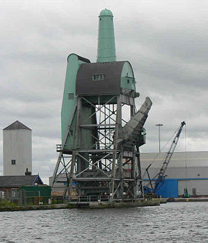
The Aire and Calder Navigation Company opened its broad canal from Knottingley in the northern sector of the coalfield in 1826, and built eight transshipment docks and a company built town. William Hamond Bartholomew the chief engineer introduced the Tom Pudding system of compartment boats, which could carry around 40 tons of coal in 1863.[3] In the docks, Bartholomew introduced large boat hoists to lift the Puddings and discharge them directly into seagoing ships to export the coal to all parts of the world. They successfully competed with rail and were used until 1985.
For most of the life of the port, coal was the dominant commodity handled. Another commodity associated with the mining industry was pit props which were traditionally stored floating in the water at the Timber Pond. With the decline of the mining industry, pit props are no longer imported. The Timber Pond is now a marina, trading under the name Goole Boathouse. It has berths for 150 boats and is the largest inland waterway marina in Yorkshire.
The Lancashire and Yorkshire Railway built a line from Pontefract and Wakefield in 1848, and the North Eastern Railway connected the port with Doncaster and Kingston upon Hull in 1870. The prosperity from the coal and general cargo trade with the West Riding's main industrial area continued for 150 years after the opening of the canal.
After a period of decline, commodities were replaced by containers, the export of steel, and the import of timber from north-eastern Europe. The two original 1826 docks, and the six built later, are still in operative. Goole railway station is on the Sheffield to Hull Line and is the terminus of the Pontefract Line.
Glass and clothing are produced in Goole, which is also the centre of an agricultural district.
The port
Three locks keep the water in 37 acres of floating docks at a constant depth of 20 feet by preventing the level from rising and falling with the tides in the River Ouse. Ships and barges entering the port must first pass through the locks. Once they are inside, eight docks provide a total of three miles of quayside at which they can berth. Beside the docks are transit sheds where cargo is stored, many of which are equipped with overhead cranes. Goole has regular cargo liner services to Norway, Sweden, Finland, Germany, the Netherlands, Belgium, France, Spain, Morocco and South Africa. There is also trade by charter vessel to and from many other countries, including Russia, Denmark and Italy. Cargo from other parts of the world such as United States of America, China and Australia reaches Goole by transshipment services from Rotterdam.
When Goole opened as a port, it was a new community of about 450 people.[4] Now it is a town with about 18,000 inhabitants.[5]
Transport by land
Goole is south of the M62 motorway linking it with Kingston upon Hull in the east and in the west with the belt of industrial towns in the centre of the West Riding. The M18 motorway runs west of the town, connecting it with Sheffield, the Midlands and the south.
Goole has a railway station with services to Hull Paragon Interchange, Doncaster, Sheffield and Leeds, and the commuter stations in between. There are bus services to surrounding towns and villages.
About the town
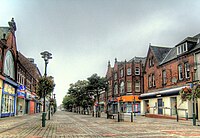
Goole has a modestly sized town centre with many high street shops, independent retailers and public houses. The main shopping area is Wesley Square, off Boothferry Road (which has been pedestrianised around the main shopping area). There is a modern retail development in the town centre and a leisure centre next to the docks.
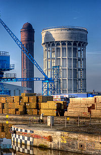
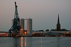
Goole's most prominent landmarks are its twin water towers, dubbed the "salt and pepper pots". In the winter months, Goole's gas holder on Anderson Road is visible across the north of the town. Many of the hoists and cranes on the dockside can be seen across the town.
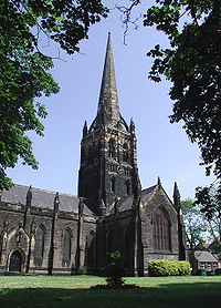
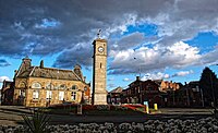
The steeple of Goole Parish Church is tall enough to be seen across the town. The town's landscape is made up mostly of utility and industrial structures. A clock tower is within the main shopping district of the town on a roundabout.
Industrial growth
Goole's industrial park, Capitol Park,[6] has attracted two large employers: Guardian Industries, which built a glass manufacturing plant, and Tesco, which built a distribution centre. The arrival of these employers resulted in hundreds of new jobs being created. A new Morrisons store opened in Goole on 2 August 2010, built on land previously occupied by Timms Mill on Boothferry Road.
Sport
- Cricket: Goole Town Cricket Club
- Football:
- Goole AFC
- Goole United AFC
- Rugby Union: Goole RUFC
- Tennis: Goole Tennis Centre
Media
- Newspapers:
- Radio:
- Radio Medica, hospital radio
- Vixen 101
- Viking FM
- KCFM (FM)
- Hallam FM
- Pulse FM
- Minster FM
- Capital FM Yorkshire
- Real Radio Yorkshire
Outside links
| ("Wikimedia Commons" has material about Goole) |
Port and shipping
- Associated British Ports - Goole Website
- Goole and Hull Port Authority
- Port of Goole
- All the ships ever built at Goole Shipyards
References
- ↑ "Goole". Associated British Ports. http://www.abports.co.uk/Our_Locations/Hull_Goole/Goole/. Retrieved 23 January 2013.
- ↑ Porteous, J.D. (1969). The Company Town of Goole: An Essay in Urban Genesis. Hull University Press. Pages 5-6
- ↑ "Tom Puddings". Goole on the Web. http://www.goole-on-the-web.org.uk/main.php?key=189. Retrieved 23 January 2013.
- ↑ Porteous, J.D. (1969). The Company Town of Goole: An Essay in Urban Genesis. Hull University Press. Page 6.
- ↑ H. Tolley and K. Orrell (1978) Yorkshire third edition ISBN 0-521-21918-3
- ↑ "Capitol Park". http://www.capitolparkgoole.co.uk/. Retrieved 23 January 2013.
- Gazetteer – A–Z of Towns Villages and Hamlets. East Riding of Yorkshire Council. 2006. p. 6.
Books
- Ferriman, Earnest and Leach, Rev. Tim (1988) Glimpses of Goole, Goole: Rev. Tim Leach, The Vicarage, Goole.
