Difference between revisions of "Foel Penolau"
(Created page with "{{Infobox hill |name=Foel Penolau |county=Merioneth |picture=Penolauu.jpg |picture caption=Foel Penolau from the summit of Moel Ysgyfarnogod |height=2,014 ft |range=Rhinogydd...") |
|||
| Line 10: | Line 10: | ||
|os grid ref=SH661348 | |os grid ref=SH661348 | ||
}} | }} | ||
| − | '''Foel Penolau''' is a top of [[Moel Ysgyfarnogod]] in [[ | + | '''Foel Penolau''' is a top of [[Moel Ysgyfarnogod]] in the [[Rhinogydd]] range in [[Merionethshire]], within the [[Snowdonia]] national Park. It is the northernmost summit of the [[Rhinogydd]]. Foel Penolau overlooks [[Llyn Trawsfynydd]], and from the summit it is possible to see the towns of [[Porthmadog]] and [[Blaenau Ffestiniog]]. |
| + | |||
| + | Long considered a mere subsidiary top of Moel Ysgyfarnogod, in 2018 two amateur surveyors determined that its relative height, based on the height of the top above the lowest point of the bwlch separating it from Moel Ysgyfarnogod, had increased doe to boulder movements, allowing Foel Penolau to be considered a mountain in its own right.<ref>'[https://www.bbc.co.uk/news/uk-wales-46441129 Foel Penolau: How a Welsh hill became a mountain]': [[BBC]] News, 5 December 2018</ref> | ||
The top is reputed to be one of the most rocky defended summits in Snowdonia, where hands must be used to attain the summit. The summit is on a large smooth slab of rock which is the surface of the outcrop which the top is made up of.<ref>Nuttall, John & Anne (1999). The Mountains of England & Wales - Volume 1: Wales (2nd edition ed.). Milnthorpe: Cicerone. {{ISBN|1-85284-304-7}}.</ref> | The top is reputed to be one of the most rocky defended summits in Snowdonia, where hands must be used to attain the summit. The summit is on a large smooth slab of rock which is the surface of the outcrop which the top is made up of.<ref>Nuttall, John & Anne (1999). The Mountains of England & Wales - Volume 1: Wales (2nd edition ed.). Milnthorpe: Cicerone. {{ISBN|1-85284-304-7}}.</ref> | ||
| − | |||
| − | |||
| − | |||
==Outside links== | ==Outside links== | ||
| − | * | + | *{{geograph|2798170|Moel Ysgyfarnogod}} |
| − | {{ | + | ==References== |
| + | {{reflist}} | ||
Latest revision as of 12:05, 9 December 2018
| Foel Penolau | |||
| Merionethshire | |||
|---|---|---|---|
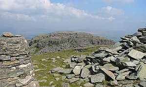
 Foel Penolau from the summit of Moel Ysgyfarnogod | |||
| Range: | Rhinogydd | ||
| Summit: | 2,014 ft SH661348 52°53’37"N, 3°59’28"E | ||
Foel Penolau is a top of Moel Ysgyfarnogod in the Rhinogydd range in Merionethshire, within the Snowdonia national Park. It is the northernmost summit of the Rhinogydd. Foel Penolau overlooks Llyn Trawsfynydd, and from the summit it is possible to see the towns of Porthmadog and Blaenau Ffestiniog.
Long considered a mere subsidiary top of Moel Ysgyfarnogod, in 2018 two amateur surveyors determined that its relative height, based on the height of the top above the lowest point of the bwlch separating it from Moel Ysgyfarnogod, had increased doe to boulder movements, allowing Foel Penolau to be considered a mountain in its own right.[1]
The top is reputed to be one of the most rocky defended summits in Snowdonia, where hands must be used to attain the summit. The summit is on a large smooth slab of rock which is the surface of the outcrop which the top is made up of.[2]
Outside links
References
- ↑ 'Foel Penolau: How a Welsh hill became a mountain': BBC News, 5 December 2018
- ↑ Nuttall, John & Anne (1999). The Mountains of England & Wales - Volume 1: Wales (2nd edition ed.). Milnthorpe: Cicerone. ISBN 1-85284-304-7.