Flexford
| Flexford | |
| Surrey | |
|---|---|
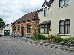
 Wanborough Station, Flexford | |
| Location | |
| Grid reference: | SU931503 |
| Location: | 51°14’40"N, 0°39’59"W |
| Data | |
| Postcode: | GU3 |
| Local Government | |
Flexford is a village to the south of Normandy in the west of Surrey, and part of the Parish of Normandy. To the south with barely a division is another hamlet of the parish, Christmaspie. It is to the north of the Hog's Back, the ridge running from Guildford due west to Farnham. The 2011 censius recorded a populaiton of 1,163.
There is a railway station here at Flexford, is unusually named Wanborough railway station, a name given for a purely historical reason connected with Lord Wanborough: the hamlet named Wanborough is a mile or so to the south. The station is on the line between Guildford to the east and Aldershot to the west, and the village can be said to have grown up around the station.
Flexford was once called 'Flaxford', referring to flax meadows by a stream.[1] The ancient industry here was the creation of linen from flax.
Bar a few outlying buildings, Flexford today is one almost inextricable, contiguous settlement with Christmaspie and the station and railway line to the north of this private estate passes over the Normandy road, residential all the way to Normandy village centre.