File:The Caiy Stane - geograph.org.uk - 526162.jpg
From Wikishire

Size of this preview: 450 × 600 pixels. Other resolution: 180 × 240 pixels.
Original file (480 × 640 pixels, file size: 124 KB, MIME type: image/jpeg)
Summary
| Description |
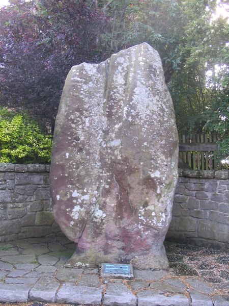
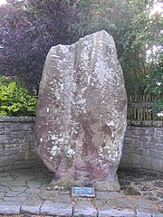
English: The Caiy Stane About 3m high, the Caiy Stane is a broad slab of red sandstone possibly marking a ritual or burial place from Neolithic times. The hilltop where it is sited continued to be used in the Bronze Age, and it may also have been the site of a battle in more recent times, with the stone as a memorial. The reverse face has six, probably prehistoric cup marks, some old graffiti and some more recent spray-painted defacings. |
| Date | |
| Source | From geograph.org.uk |
| Author | M J Richardson |
| Attribution (required by the license) | M J Richardson / The Caiy Stane / |
| Camera location | | View this and other nearby images on: OpenStreetMap |
|---|
_heading:90.00&language=en)
| Object location | | View this and other nearby images on: OpenStreetMap |
|---|
_heading:90.00&language=en)
Licensing

|
This image was taken from the Geograph project collection. See this photograph's page on the Geograph website for the photographer's contact details. The copyright on this image is owned by M J Richardson and is licensed for reuse under the Creative Commons Attribution-ShareAlike 2.0 license.
|
This file is licensed under the Creative Commons Attribution-Share Alike 2.0 Generic license.
Attribution: M J Richardson
- You are free:
- to share – to copy, distribute and transmit the work
- to remix – to adapt the work
- Under the following conditions:
- attribution – You must give appropriate credit, provide a link to the license, and indicate if changes were made. You may do so in any reasonable manner, but not in any way that suggests the licensor endorses you or your use.
- share alike – If you remix, transform, or build upon the material, you must distribute your contributions under the same or compatible license as the original.
- Remove redundant categories and try to put this image in the most specific category/categories
- Remove this template
- The location categories are based on information from this geonames tool and this OpenStreetMap tool combined with a database. You can also have a look at this tool from mysociety.
- The topic category from Geograph was Archaeology (find similar images at Geograph)
File history
Click on a date/time to view the file as it appeared at that time.
| Date/Time | Thumbnail | Dimensions | User | Comment | |
|---|---|---|---|---|---|
| current | 17:43, 5 February 2011 | | 480 × 640 (124 KB) | GeographBot | == {{int:filedesc}} == {{Information |description={{en|1=The Caiy Stane About 3m high, the Caiy Stane is a broad slab of red sandstone possibly marking a ritual or burial place from Neolithic times. The hilltop where it is sited continued to be used in th |
File usage
The following file is a duplicate of this file (more details):
- File:The Caiy Stane - geograph.org.uk - 526162.jpg from a shared repository
The following page links to this file: