File:Richard of York Memorial - geograph.org.uk - 858000.jpg
From Wikishire

Size of this preview: 450 × 600 pixels. Other resolution: 180 × 240 pixels.
Original file (480 × 640 pixels, file size: 415 KB, MIME type: image/jpeg)
Summary
| Description |
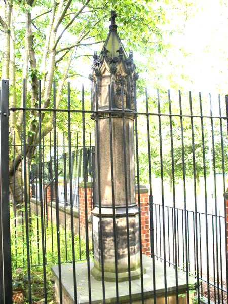
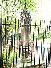
English: Richard of York Memorial, near to Wakefield, Great Britain.
The Richard of York Memorial was erected over 110 years ago marking the spot where Richard Plantagenet fell in the Battle of Wakefield 1460. |
| Date | |
| Source | From this image at geograph.org.uk; transferred by User:RHaworth using geograph_org2commons. |
| Author | SMJ |
| Permission (Reusing this file) |
Creative Commons Attribution Share-alike license 2.0 |
| Attribution (required by the license) | SMJ / Richard of York Memorial / |
| Camera location | | View this and other nearby images on: OpenStreetMap |
|---|
| Object location | | View this and other nearby images on: OpenStreetMap |
|---|
_region:GB-ENG_heading:67.00&language=en)
Licensing

|
This image was taken from the Geograph project collection. See this photograph's page on the Geograph website for the photographer's contact details. The copyright on this image is owned by SMJ and is licensed for reuse under the Creative Commons Attribution-ShareAlike 2.0 license.
|
This file is licensed under the Creative Commons Attribution-Share Alike 2.0 Generic license.
Attribution: SMJ
- You are free:
- to share – to copy, distribute and transmit the work
- to remix – to adapt the work
- Under the following conditions:
- attribution – You must give appropriate credit, provide a link to the license, and indicate if changes were made. You may do so in any reasonable manner, but not in any way that suggests the licensor endorses you or your use.
- share alike – If you remix, transform, or build upon the material, you must distribute your contributions under the same or compatible license as the original.
File history
Click on a date/time to view the file as it appeared at that time.
| Date/Time | Thumbnail | Dimensions | User | Comment | |
|---|---|---|---|---|---|
| current | 13:11, 3 March 2016 | | 480 × 640 (415 KB) | TedColes | Reverted to version as of 13:09, 3 March 2016 (UTC) |
File usage
The following file is a duplicate of this file (more details):
- File:Richard of York Memorial - geograph.org.uk - 858000.jpg from a shared repository
The following page links to this file: