File:Kennington Park - geograph.org.uk - 1009307.jpg
From Wikishire
No higher resolution available.
Kennington_Park_-_geograph.org.uk_-_1009307.jpg (640 × 480 pixels, file size: 220 KB, MIME type: image/jpeg)
Summary
| Description |
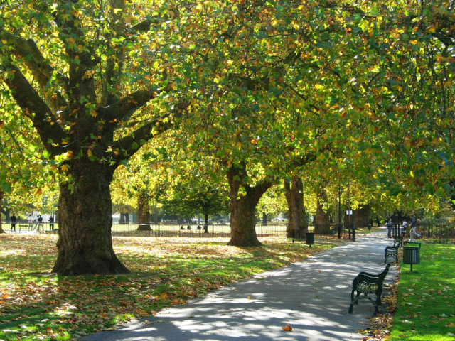
English: Kennington Park Kennington Park was originally common land, but was laid out as a park in the mid-19th century. In the 17th and 18th centuries it was the site of public executions and in 1848 a major chartist rally was held here which led directly to a change in the law extending the franchise in 1852. During the Second World War a communal shallow-trench air raid shelter was built here which suffered a direct hit in October 1940 killing at least 46 people. The full story of this terrible event is told here: http://www.vauxhallandkennington.org.uk/forgottentragedy.pdf . |
| Date | |
| Source | From geograph.org.uk |
| Author | Stephen McKay |
| Attribution (required by the license) | Stephen McKay / Kennington Park / |
| Camera location | | View this and other nearby images on: OpenStreetMap |
|---|
_heading:180.00&language=en)
| Object location | | View this and other nearby images on: OpenStreetMap |
|---|
_heading:180.00&language=en)
Licensing

|
This image was taken from the Geograph project collection. See this photograph's page on the Geograph website for the photographer's contact details. The copyright on this image is owned by Stephen McKay and is licensed for reuse under the Creative Commons Attribution-ShareAlike 2.0 license.
|
This file is licensed under the Creative Commons Attribution-Share Alike 2.0 Generic license.
Attribution: Stephen McKay
- You are free:
- to share – to copy, distribute and transmit the work
- to remix – to adapt the work
- Under the following conditions:
- attribution – You must give appropriate credit, provide a link to the license, and indicate if changes were made. You may do so in any reasonable manner, but not in any way that suggests the licensor endorses you or your use.
- share alike – If you remix, transform, or build upon the material, you must distribute your contributions under the same or compatible license as the original.
File history
Click on a date/time to view the file as it appeared at that time.
| Date/Time | Thumbnail | Dimensions | User | Comment | |
|---|---|---|---|---|---|
| current | 07:36, 23 February 2011 | | 640 × 480 (220 KB) | GeographBot | == {{int:filedesc}} == {{Information |description={{en|1=Kennington Park Kennington Park was originally common land, but was laid out as a park in the mid-19th century. In the 17th and 18th centuries it was the site of public executions and in 1848 a maj |
File usage
The following file is a duplicate of this file (more details):
- File:Kennington Park - geograph.org.uk - 1009307.jpg from a shared repository
The following page links to this file: