File:Dogdyke - geograph.org.uk - 109241.jpg
From Wikishire
No higher resolution available.
Dogdyke_-_geograph.org.uk_-_109241.jpg (640 × 480 pixels, file size: 525 KB, MIME type: image/jpeg)
Summary
| Description |
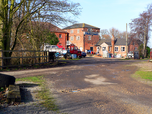
English: Dogdyke. The line carrying Flanders & Swann's "Slow Train" ran across the frame - a solitary sleeper hints at a busier past. The buildings are now occupied by the Bell Isle Marina and its Buccaneer Bar. See also 110677 |
| Date | |
| Source | From geograph.org.uk |
| Author | Ian Carrington |
| Attribution (required by the license) | Ian Carrington / Dogdyke / |
| Camera location | | View this and other nearby images on: OpenStreetMap |
|---|
_&language=en)
| Object location | | View this and other nearby images on: OpenStreetMap |
|---|
_&language=en)
The buildings shown in the picture are the former Sinclairs Mill buildings and nothing to do with the railway. However the track bed of the railway is in the foreground although unrecognisable. The former railway buildings were demolished a few years ago.
Licensing

|
This image was taken from the Geograph project collection. See this photograph's page on the Geograph website for the photographer's contact details. The copyright on this image is owned by Ian Carrington and is licensed for reuse under the Creative Commons Attribution-ShareAlike 2.0 license.
|
This file is licensed under the Creative Commons Attribution-Share Alike 2.0 Generic license.
Attribution: Ian Carrington
- You are free:
- to share – to copy, distribute and transmit the work
- to remix – to adapt the work
- Under the following conditions:
- attribution – You must give appropriate credit, provide a link to the license, and indicate if changes were made. You may do so in any reasonable manner, but not in any way that suggests the licensor endorses you or your use.
- share alike – If you remix, transform, or build upon the material, you must distribute your contributions under the same or compatible license as the original.
File history
Click on a date/time to view the file as it appeared at that time.
| Date/Time | Thumbnail | Dimensions | User | Comment | |
|---|---|---|---|---|---|
| current | 22:43, 30 January 2010 | | 640 × 480 (525 KB) | GeographBot | == {{int:filedesc}} == {{Information |description={{en|1=Dogdyke. The line carrying Flanders & Swann's "Slow Train" ran across the frame - a solitary sleeper hints at a busier past. The buildings are now occupied by the Bell Isle Marina and its Buccaneer |
File usage
The following file is a duplicate of this file (more details):
- File:Dogdyke - geograph.org.uk - 109241.jpg from a shared repository
The following page links to this file: