File:Blyth map c.1860.jpg
From Wikishire

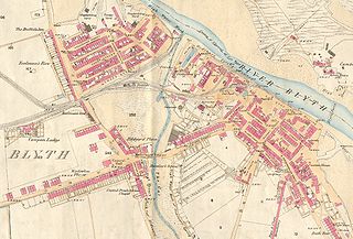
Size of this preview: 800 × 542 pixels. Other resolution: 320 × 217 pixels.
Original file (1,103 × 747 pixels, file size: 755 KB, MIME type: image/jpeg)

|
This file was moved to Wikimedia Commons from en.wikipedia using a bot script. All source information is still present. It requires review. Additionally, there may be errors in any or all of the information fields; information on this file should not be considered reliable and the file should not be used until it has been reviewed and any needed corrections have been made. Once the review has been completed, this template should be removed. For details about this file, see below. Check now! |
| Description |
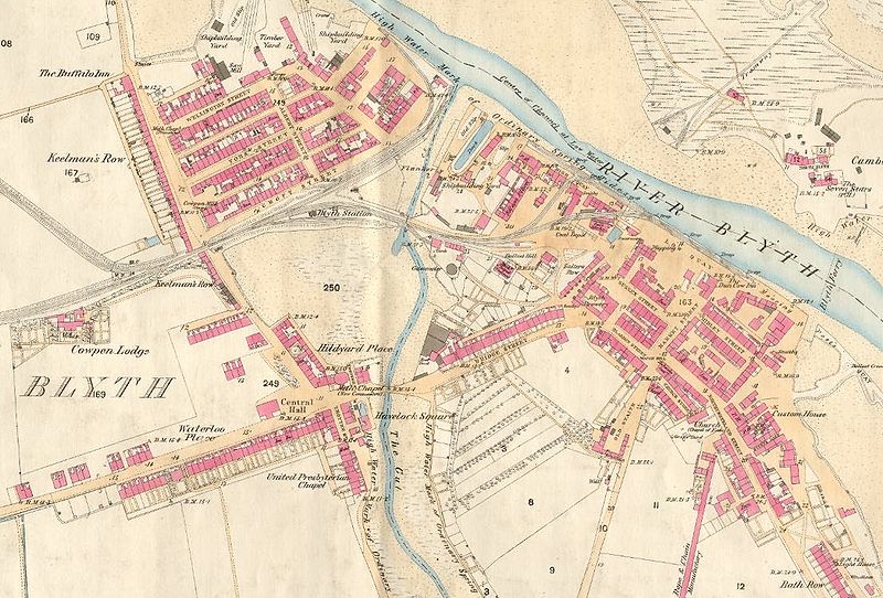
English: First edition Ordnance Survey map of Blyth, circa 1860 |
| Date | Early 1860s |
| Source | Reproduced from the 1860 Ordnance Survey Map; obtained from http://communities.northumberland.gov.uk/004891FS.htm |
| Author | Ordnance Survey |
Licensing
This work is an Ordnance Survey map over 50 years old, which is covered by Crown Copyright which in this case expires 50 years after publication. Ordnance Survey does however ask that they be credited and that the date of publication be given.
Any ancillary rights gained through the creation of the electronic version are granted as freely usable under any circumstances.
|
This work created by the United Kingdom Government is in the public domain.
This is because it is one of the following:
HMSO has declared that the expiry of Crown Copyrights applies worldwide (ref: HMSO Email Reply)
|
 |
Original upload log
Transferred from en.wikipedia to Commons by Oxyman using CommonsHelper.
The original description page was here. All following user names refer to en.wikipedia.
- 2007-09-09 18:07 Dbam 1103×747× (773396 bytes) {{Non-free use rationale |Description=First edition Ordnance Survey map, circa 1860 |Source=Reproduced from the 1860 Ordnance Survey Map; obtained from http://communities.northumberland.gov.uk/Blyth_C14.htm |Portion=Edges cropped by uploader |Low_resoluti
File history
Click on a date/time to view the file as it appeared at that time.
| Date/Time | Thumbnail | Dimensions | User | Comment | |
|---|---|---|---|---|---|
| current | 23:31, 5 October 2009 | | 1,103 × 747 (755 KB) | File Upload Bot (Magnus Manske) | {{BotMoveToCommons|en.wikipedia|year={{subst:CURRENTYEAR}}|month={{subst:CURRENTMONTHNAME}}|day={{subst:CURRENTDAY}}}} {{Information |Description={{en|First edition Ordnance Survey map of en:Blyth, Northumberland, circa 1860}} |Source=Transferred f |
File usage
The following file is a duplicate of this file (more details):
- File:Blyth map c.1860.jpg from a shared repository
The following page links to this file: