Fetteresso
| Fetteresso | |
| Kincardineshire | |
|---|---|
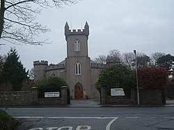
 Fetteresso Parish Church | |
| Location | |
| Location: | 56°57’39"N, 2°16’14"W |
| Data | |
| Post town: | Stonehaven |
| Postcode: | AB39 |
| Dialling code: | 01569 |
| Local Government | |
| Council: | Aberdeenshire |
Fetteresso is a parish in Kincardineshire, situated on the north bank of the River Carron, lying exposed to the North Sea on the east. The parish contains Newtonhill, Muchalls and part of Stonehaven. The A90 trunk road from Stonehaven to Aberdeen passes through the parish near the North Sea coast.
The landscape consists largely of moorland. It is watered in the interior by the River Cowrie, and by one or two burns falling into the sea.
The church, which stands near Stonehaven, was built in 1813.
The principal seats are Fetteresso Castle, the ancient seat of the Keiths; Uric House, formerly of the Barclays; Rickarton House, and Muchals House. At King's Dyke is a Roman camp, supposed to have been that of Agricola, previous to the battle with Galgacus. At Kempstane Moor tumuli and Druidical remains are of frequent occurrence. There are remains of a chapel and an ancient burial-ground on the coast not far from Stonehaven, with the ruins of a residence of the ancient Thanes of Cowie.
This Kincardineshire article is a stub: help to improve Wikishire by building it up.