Erwood
| Erwood Welsh: Erwyd | |
| Brecknockshire | |
|---|---|
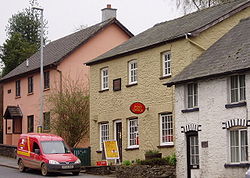
 Erwood post office | |
| Location | |
| Grid reference: | SO0958443094 |
| Location: | 52°4’42"N, 3°19’10"W |
| Data | |
| Post town: | Builth Wells |
| Postcode: | LD2 |
| Dialling code: | 01982 |
| Local Government | |
| Council: | Powys |
| Parliamentary constituency: |
Brecon & Radnorshire |
Erwood is a village and parish in Brecknockshire lying beside the River Wye, on the A470 road some six miles south-east of Builth Wells.
The Clettwr brook, flowing from west to east before turning north through the village to join the River Wye, divides Erwood between the two ecclesiastical parishes of Gwenddwr, to the northwest, and Crickadarn, to the south-east. The church of Saint Dubricius in Gwenddwr was extensively rebuilt in the Victorian period after a fire.[1] In former times drovers would ford the Wye at Erwood on their journey towards the Midlands and eventually London, where they would sell their livestock.
Erwood is overlooked from across the Wye by the ancient hill-fort of Twyn y Garth.[2] On its 1,066-foot-high summit is a German field howitzer, a trophy from World War I. The fact that it is pointing towards Erwood from neighbouring Radnorshire is part of a local running joke.
At the southern end of the parish, on the Scithwen Brook, is Trericket Mill where Roderick Murchison recorded in the 1830s that he had identified "the first true Silurian".[3]
Village name
The name Erwood is of uncertain origin and is recorded in numerous forms over the centuries. It may derive from the rare cerwyd meaning 'stag' with subsequent anglicization to '-wood'. It is known in Welsh as Erwyd which may be a cymricization of Erwood.[4]
Village life
The parish consists of the village, the two ancient parishes of Gwenddwr and Crickadarn, and the former Forestry Commission hamlet of Llaneglwys. The village is the centre of a flourishing branch of the Young Farmers' Club. The village shop and post office no longer exists, and of the two pubs one, The Erwood Inn, has recently changed to a private house offering bed and breakfast accommodation.
Until 1962 Erwood railway station, about half-a-mile away, served the village. Now a renowned Centre for the Arts Erwood Station Craft Centre, Gallery & Tea Rooms
References
| ("Wikimedia Commons" has material about Erwood) |
- ↑ [1]
- ↑ Ordnance Survey of the United Kingdom
- ↑ Duncan Hawley, Proceedings of the Geologists' Association
- ↑ owen, H.W. and Morgan, R. 2007 Dictionary of the Place-names of Wales Gomer Press, Cardiganshire ISBN 9781843239017