Difference between revisions of "Ebrington Hill"
From Wikishire
(Created page with '{{Infobox hill |name=Ebrington Hill |county 1=Gloucestershire |county 2=Warwickshire |picture=Ebrington Hill Farm - geograph.org.uk - 101879.jpg |picture caption=Ebrington Hill F…') |
|||
| Line 7: | Line 7: | ||
|height=856 feet | |height=856 feet | ||
|os grid ref=SP1877942633 | |os grid ref=SP1877942633 | ||
| + | |latitude=52.081739 | ||
| + | |longitude=-1.727377 | ||
}} | }} | ||
'''Ebrington Hill''' is a modest hill in the edge of the [[Cotswolds]]. Its top is in [[Gloucestershire]], and part of its flank in [[Warwickshire]]. | '''Ebrington Hill''' is a modest hill in the edge of the [[Cotswolds]]. Its top is in [[Gloucestershire]], and part of its flank in [[Warwickshire]]. | ||
| − | The county | + | The county border runs over the Ebrington Hill Shoulder just a few yards off the summit and here on the shoulder on the boundary is Warwickshire's [[county top]], at 853 feet above sea level ({{getmapecho|SP187425}}). |
On the hilltop, within Gloucestershire, stands a communications array. | On the hilltop, within Gloucestershire, stands a communications array. | ||
==Outside links== | ==Outside links== | ||
| − | [[File:Communications station, Ebrington Hill - geograph.org.uk - 406602.jpg| | + | [[File:Communications station, Ebrington Hill - geograph.org.uk - 406602.jpg|left|thumb|200px|Communications array on the hilltop]] |
[[Category:County tops]] | [[Category:County tops]] | ||
Latest revision as of 17:09, 21 March 2018
| Ebrington Hill | |
| Gloucestershire, Warwickshire | |
|---|---|
 Ebrington Hill Farm | |
| Summit: | 856 feet SP1877942633 52°4’54"N, 1°43’39"W |
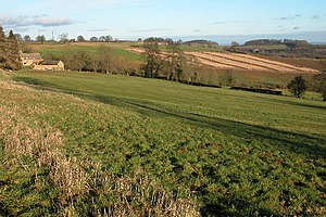
Ebrington Hill is a modest hill in the edge of the Cotswolds. Its top is in Gloucestershire, and part of its flank in Warwickshire.
The county border runs over the Ebrington Hill Shoulder just a few yards off the summit and here on the shoulder on the boundary is Warwickshire's county top, at 853 feet above sea level (SP187425).
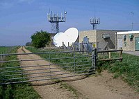
On the hilltop, within Gloucestershire, stands a communications array.
