Derryhale
From Wikishire
| Derryhale | |
| County Armagh | |
|---|---|
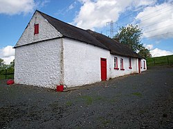
 Boyd's cottage, Derryhale, in 2007 | |
| Location | |
| Grid reference: | H988495 |
| Location: | 54°23’6"N, 6°28’48"W |
| Data | |
| Population: | 360 (2011) |
| Postcode: | BT62 |
| Dialling code: | 028 |
| Local Government | |
Derryhale is a small village and townland (of 834 acres) in County Armagh. It sits between Portadown, Richhill and Tandragee (in the Barony of Oneilland West).
The village had a population of 360 people (in 129 households) at the 2011 Census.[1] (2001 Census: 246 people)
The name of the place is form the Irish Doire Chaol, meaning 'Narrow oakwood'[2]
Archaeology
A Bronze Age hoard was found at Derryhale and included a star-shaped faience bead, knives with ridged tangs and pins.[3]
Outside links
| ("Wikimedia Commons" has material about Derryhale) |
References
- ↑ "Derryhale". NI Statistics and Research Agency. http://www.nisra.gov.uk/census/2011/results/settlements.html. Retrieved 22 April 2015.
- ↑ Derryhale - Placenames NI
- ↑ Flanagan, L (1992). A Dictionary of Irish Archaeology. Dublin: Gill and Macmillan. pp. 32, 135, 174.
