Dassels
From Wikishire
Revision as of 23:15, 22 June 2012 by RB (Talk | contribs) (Created page with '{{Infobox town |name=Dassels |county=Hertfordshire |picture=Cottages, Dassels - geograph.org.uk - 471696.jpg |picture caption=Cottages at Dassels |os grid ref=TL392273 |latitude=…')
| Dassels | |
| Hertfordshire | |
|---|---|
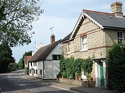
 Cottages at Dassels | |
| Location | |
| Grid reference: | TL392273 |
| Location: | 51°55’38"N, 0°1’26"E |
| Data | |
| Postcode: | SG11 |
| Local Government | |
| Council: | East Hertfordshire |
Dassels is a hamlet in Hertfordshire. Nearby places include the town of Ware and the village of Braughing.
Dassels stands on the B1368 road north of Braughing. It is near the River Quin, whose modest valley the road follows down to Braughing.
This Hertfordshire article is a stub: help to improve Wikishire by building it up.