Culmington
From Wikishire
Revision as of 20:53, 28 January 2016 by FixerBot (Talk | contribs) (clean up, typos fixed: the the → the)
| Culmington | |
| Shropshire | |
|---|---|

| |
| Location | |
| Grid reference: | SO499817 |
| Location: | 52°25’53"N, 2°44’17"W |
| Data | |
| Postcode: | SY8 |
| Local Government | |
| Council: | Shropshire |
| Parliamentary constituency: |
Ludlow |
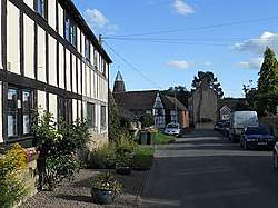
Culmington is a small village in southern Shropshire. The River Corve skirts the east of the village, and here turns south as the land opens; Culmington may therefore be considered to stand at the foot of Corvedale.
To the south along the B4365 road is the village, north of Stanton Lacy, and beyond it Ludlow, the major town of this part of the county. Craven Arms is to the west.