Combe Moor
| Combe Moor | |
| Herefordshire | |
|---|---|
 Combe Moor and Byton Moor, just north of the village | |
| Location | |
| Grid reference: | SO365629 |
| Location: | 52°15’44"N, 2°56’2"W |
| Data | |
| Local Government | |
| Council: | Herefordshire |
| Parliamentary constituency: |
Hereford and South Herefordshire |
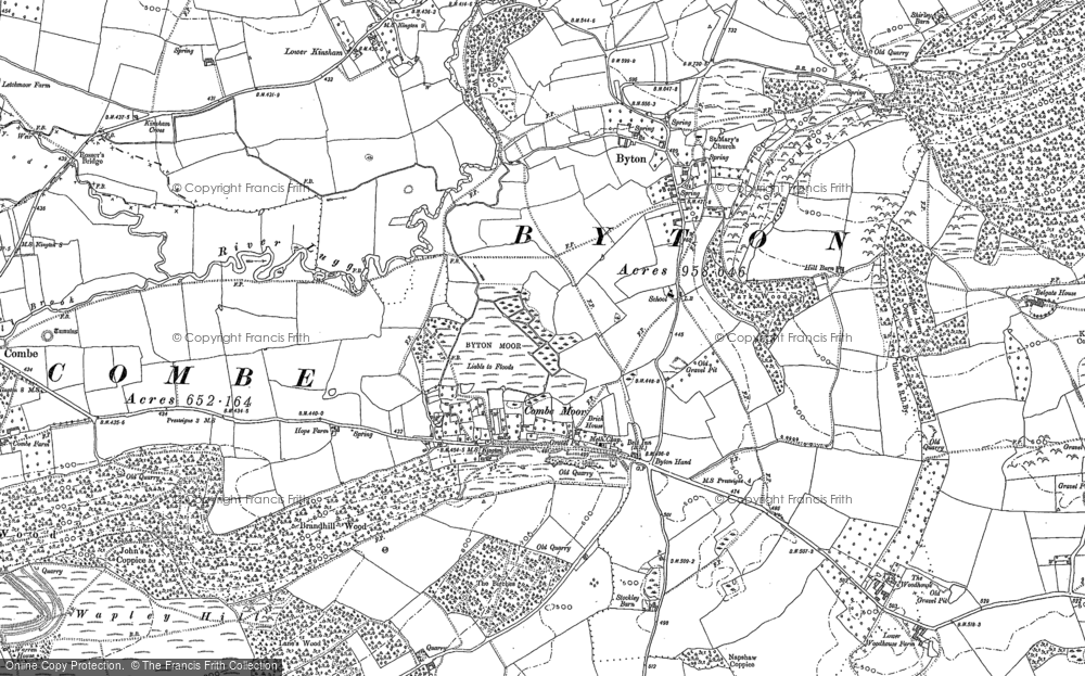
Combe Moor, also known as Coombes Moor, is a small linear village in Herefordshire, located to the southeast of Presteigne, in Radnorshire and twenty miles north-west by road from Hereford. It is to be found on the B4362 road between Shobdon and Presteigne, near the meeting of the Hindwell Brook and the River Lugg.
Geography

The village is located on a flat plain of the River Lugg, which has hills rising at each side. During the Devensian period, "the eastward advance of the Wye Glacier blocked the preglacial Lugg at Combe Moor and the river cut a new course to the north-east before turning south-east through the east-west ridge via the Covenhope Gap."[1] Cross and Hodgson described the sediments of the Combe Moor basin in 1975 as "finely laminated and stoneless."[2]
Combe Moor lies to the southeast of Combe, just to the south-west of Byton. Brandhill Wood lies to the south and Park Hill to the north-east. The moor to the north of the village is called Byton Moor and there is also a moor of the same name as the village just to the west of that.
The Herefordshire Trail long distance footpath passes through the village.
About the village
The Herefordshire Trail leads to Wapley Hillfort. There is an old schoolhouse located to the north-east along the road to Byton.
Mistletoe House in the village is a "rural tea room and gallery with a colourful garden".[3] Other cottages in the vicinity include Rue Cottage in the village itself and Wapley cottage along the lane to the south-east.
Outside links
References
- ↑ Stephens, Nicholas (6 September 1990). Natural Landscapes of Britain from the Air. CUP Archive. p. 155. ISBN 978-0-521-32390-1. https://books.google.com/books?id=0yE9AAAAIAAJ&pg=PA155. Retrieved 16 August 2012.
- ↑ Dorling, Peter (2007). The Lugg Valley, Herefordshire: archaeology, landscape change and conservation. Herefordshire Archaeology. p. 53. ISBN 978-0-9546998-2-6. https://books.google.com/books?id=gQQMAQAAMAAJ. Retrieved 16 August 2012.
- ↑ "Mistletoe-House-Presteigne". Qype. http://www.qype.co.uk/place/1495270-Mistletoe-House-Presteigne. Retrieved 16 August 2012.