Comb Fell
From Wikishire
Revision as of 22:42, 30 August 2015 by RB (Talk | contribs) (Created page with "{{Infobox hill |name=Comb Fell |county=Northumberland |picture=Comb Fell from The Cheviot - geograph.org.uk - 433280.jpg |picture caption=Comb Fell from The Cheviot |os grid r...")
| Comb Fell | |
| Northumberland | |
|---|---|
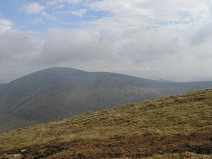
 Comb Fell from The Cheviot | |
| Summit: | 2,139 feet NT924187 55°27’40"N, 2°7’10"W |
Comb Fell is a hill of the Cheviots, standing on the south side of the Harthope Valley, between Hedgehope Hill to the north-east and Cairn Hill to the north-west.
The hill reaches a height of 2,139 feet, making it one of the highest of the Cheviots.
Outside links
| ("Wikimedia Commons" has material about Comb Fell) |