Clayhithe
| Clayhithe | |
| Cambridgeshire | |
|---|---|
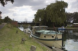
 Clayhithe Bridge on the Cam | |
| Location | |
| Grid reference: | TL501644 |
| Location: | 0°11’56"N, 52°15’27"E |
| Data | |
| Post town: | Cambridge |
| Postcode: | CB25 |
| Local Government | |
| Council: | South Cambridgeshire |
Clayhithe is a hamlet in Cambridgeshire, on the River Cam north of Cambridge. The village of Waterbeach stands barely half a mile northwest, separated from Clayhithe by the main railway line.
There is a bridge over the Cam at Clayhiithe. The village owes its existence to the river and the trade it once brought: the village’s name is Old English for "Clay port".
The village has a pub, The Bridge, much rfrequented by rowers from the University and boatmen from further afield.
The Conservators of the River Cam
The Conservators of the River Cam used to meet in Clayhithe and it is still the residence of the River Foreman and the location of important workshiops for the Conservancy.
The Conservators' House, the Foreman's residence, stands by the river here; it was built in 1842 and was used by the Conservators for their meetings. In the grounds of the house are two workshops where the river team carry out a wide range of maintenance and engineering work; weed cutting, lock maintenance, tree cutting, bank piling, salvage and managing river levels.
