Charminster
From Wikishire
- Not to be confused with Charminster, Bournemouth
| Charminster | |
| Dorset | |
|---|---|
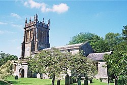
 Parish church of St Mary's | |
| Location | |
| Grid reference: | SY680927 |
| Location: | 50°43’58"N, 2°27’17"W |
| Data | |
| Population: | 2,940 (2011) |
| Local Government | |
| Council: | Dorset |
| Parliamentary constituency: |
West Dorset |
Charminster is a charming village in Dorset, on the River Cerne one mile north of the county town, Dorchester. The A352 road runs through the village.
The 2011 census recorded a parish population of 2,940.
The village's name derives from that of the River Cerne and the small 'minster' church of St Mary. The village is recorded in the Domesday Book]] of 1086 and then in 1223 as Cerneminster, which eventually evolved into Charminster.[1]
In the village stands Wolfeton House, which has a chapter in early American history as the home of Richard Norman, one of the Planters of the Massachusetts Bay Colony in America in around 1626.[2]
Outside links
| ("Wikimedia Commons" has material about Charminster) |
References
- ↑ Mills, A.D.: 'Dorset Place Names' (Ensign, 1986) ISBN 1-85455-065-9
- ↑ Leslie Mahler, "The English Origin of Richard Norman of Salem, Massachusetts." The American Genealogist, Vol. 77, No. 2 (April 2002).