Carter Fell
From Wikishire
Revision as of 11:05, 31 January 2015 by RB (Talk | contribs) (Created page with "{{Infobox hill |name=Carter Fell |county 1=Northumberland |county 2=Roxburghshire |range=Cheviot Hills |picture=Goat Fence and gate at Carter Fell - geograph.org.uk - 848216.j...")
| Carter Fell | |||
| Northumberland, Roxburghshire | |||
|---|---|---|---|
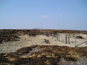
 Goat Fence on Carter Fell | |||
| Range: | Cheviot Hills | ||
| Summit: | 1,900 feet NT682052 55°20’24"N, 2°30’9"W | ||
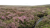
Carter Fell is a mountain of the Cheviots, consisting of a long, shallow ridge, heather-clad and wooded on the lower slopes. It reaches 1,900 feet above sea level.
The ridge and the summit mark the boundary between Northumberland to the south and Roxburghshire to the north. The summit is marked by a trig point.
An ancient pass through the hills known as Carter Bar is at the northeast edge of the fell ridge. It now carries the A68 Newcastle to Edinburgh road; in former days it was a major drove road, and a border crossing before the Union, and long before that a Roman Road, Dere Street, took this route through the Cheviots.
