Brookthorpe
From Wikishire
Revision as of 19:31, 25 January 2020 by RB (Talk | contribs) (Created page with "{{Infobox town |name=Brookthorpe |county=Gloucestershire |picture=Brookthorpe (Glos) St Swithin's Church - geograph.org.uk - 68202.jpg |picture caption=St Swithin's, Brookthor...")
| Brookthorpe | |
| Gloucestershire | |
|---|---|
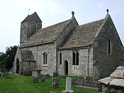
 St Swithin's, Brookthorpe | |
| Location | |
| Grid reference: | SO837121 |
| Location: | 51.80851.808 -2.237 |
| Data | |
| Local Government | |
| Council: | Stroud |
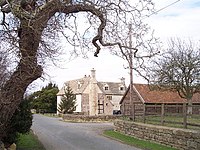
Brookthorpe is a village in Gloucestershire.
The church in the village, St Swithun's, was built in the 13th century. A north aisle was added in 1892 during a restoration. It has ceased to be used for worship and is now under the care of the Churches Conservation Trust.[1] It is a Grade II* listed building.[2] The parish church today is St Margaret's in Harescombe.
Outside links
| ("Wikimedia Commons" has material about Brookthorpe) |
References
- ↑ St Swithun's Church, Brookthorpe: The Churches Conservation Trust
- ↑ National Heritage List 1340597: Church of St Swithin, Brookthorpe With Whaddon
