Difference between revisions of "Brandlingill"
From Wikishire
(No difference)
| |
Latest revision as of 17:26, 22 June 2017
| Brandlingill | |
| Cumberland | |
|---|---|
 Brandlingill | |
| Location | |
| Grid reference: | NY122265 |
| Location: | 54°37’34"N, 3°21’39"W |
| Data | |
| Post town: | Cockermouth |
| Postcode: | CA13 |
| Dialling code: | 01900 |
| Local Government | |
| Council: | Cumberland |
| Parliamentary constituency: |
Copeland |
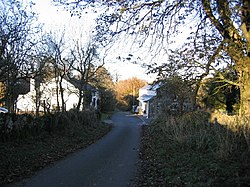
Brandlingill is a village in Cumberland, at the foot of Fellbarrow. Two and a half miles south of Cockermouth.
The Sandy Beck runs by the village heading eastward to join the River Cocker a mile downstream.