Bowerhope Law
| Bowerhope Law | |||
| Selkirkshire | |||
|---|---|---|---|
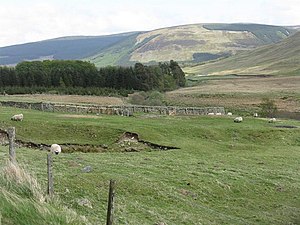
 Bowerhope Law from the valley of the Megget Water | |||
| Range: | Ettrick Hills | ||
| Summit: | 1,568 feet NT251218 55°29’5"N, 3°11’12"W | ||
Bowerhope Law is a hill of 1,568 feet overlooking St Mary's Loch in Selkirkshire. It is within the Ettrick Forest, in a ridge of hills between the loch and the Yarrow Water to the north and the Ettrick Water to the south, with the Wiss (1,932 feet) to the south.
The hill stands at the edge of the loch, climbing steeply form the shore. To the east ot falls to the Bowerhope Burn, which runs down to the loch shore at Bowerhope and whose valley gives a name to the village and to the hill, from the Old Scots "hope", meaning "valley". Thus the hill's name is ultimately from the Old English gebur hopa hlaw: "farm valley hill". Across the loch is Cappercleuch, in Peeblesshire.
Across the little valley is Peat Law, Selkirkshire (1,742 feet), a spur of the Wiss.