Bow
| Bow | |
| Middlesex | |
|---|---|
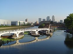
 Bow Locks, Bromley-by-Bow | |
| Location | |
| Grid reference: | TQ365825 |
| Location: | 51°31’47"N, 0°1’44"W |
| Data | |
| Post town: | London |
| Postcode: | E3 |
| Dialling code: | 020 |
| Local Government | |
| Council: | Tower Hamlets |
| Parliamentary constituency: |
Bethnal Green and Bow |
Bow is a part of the East End of London, but a distinct town with its own character. Strung out eastward from the City's Aldgate is a series of villages run into one urban mass; Whitechapel, Stepney, Mile End, and finally Bow. Beyond Bow is the River Lea; Middlesex's eastern border, and beyond that is Stratford.
Bow is mentioned in the Canterbury Tales by its earlier name of Stratford-atte-'Bow ("Stratford at the bow"), a counterpart to Stratford (or Stratford Langthorne) in Essex across the river; both are named for old Roman street and the ford it crosses there. Bow was known in Anglo-Saxon days as Strætford. The town retained the name into the nineteenth century: Thomas Moule's maps published from 1830 show it variously as "Bow" and as "Stratford le Bow". The "bow" is the bow in the River Lea by which it stands.
This Middlesex article is a stub: help to improve Wikishire by building it up.