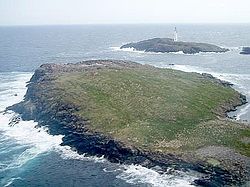
Bound Skerry
From Wikishire
Revision as of 12:11, 3 July 2012 by RB (Talk | contribs) (Created page with '{{Infobox island |name=Bound Skerry |county=Shetland |group=Out Skerries |picture=Grunay.jpg |picture caption=Grunay with Bound Skerry behind |os grid ref=HU702719 |latitude=60.4…')
| Bound Skerry | |
 Grunay with Bound Skerry behind | |
|---|---|
| Location | |
| Location: | 60°25’48"N, 0°43’12"W |
| Grid reference: | HU702719 |
| Data | |
| Population: | 0 |
Bound Skerry is part of the Out Skerries group of Shetland. It is uninhabited. As well as being the most easterly island of the county, it is also the easternmost point of Scotland.
The island has a lighthouse on it, which was built in 1857 at the cost of £21,000. George Stevenson, the great lighthouse engineer, was responsible for building the lighthouse builders, and the signature of Robert Louis Stevenson, the writer of the family, can be seen in its guestbook.[1] The keepers lived on nearby Grunay.
The island was bombed by the Germans twice during the Second World War, as thought it was a munitions factory.[1]
References
- ↑ 1.0 1.1 Haswell-Smith, Hamish (2004). The Scottish Islands. Edinburgh: Canongate. ISBN 1841954543.
| The Out Skerries |
|---|