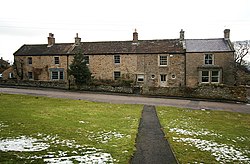
Boldron
From Wikishire
Revision as of 08:36, 1 October 2017 by RB (Talk | contribs) (Created page with "{{Infobox town |name=Boldron |county=York |riding=North |picture=Boldron House and Newton Cottage - geograph.org.uk - 1737969.jpg |picture caption=Boldron |os grid ref=NZ03414...")
| Boldron | |
| Yorkshire North Riding | |
|---|---|
 Boldron | |
| Location | |
| Grid reference: | NZ034143 |
| Location: | 54°31’28"N, 1°56’54"W |
| Data | |
| Population: | 109 (2011) |
| Post town: | Barnard Castle |
| Postcode: | DL12 9R |
| Local Government | |
| Council: | Durham |
Boldron is a village in the North Riding of Yorkshire and within the Pennines. It is just north of the A68 trans-Pennine trunk road, between the Greta Valley to the south and Teesdale to the south. A lane runs down to the latter dale to Startforth, across the River Tees from Barnard Castle, Boldron's nearest town, which stands across the river in County Durham.
Outside links
| ("Wikimedia Commons" has material about Boldron) |
- The History of Boldron at Tomorrows-history.com