Bedhampton
| Bedhampton | |
| Hampshire | |
|---|---|
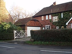
 An older style house in Old Bedhampton | |
| Location | |
| Grid reference: | SU703067 |
| Location: | 50°51’20"N, 1°0’8"W |
| Data | |
| Population: | 8,835 (2011) |
| Post town: | Havant |
| Postcode: | PO9 |
| Local Government | |
| Council: | Havant |
| Parliamentary constituency: |
Havant |
Bedhampton is a village in the south-east of Hampshire, now become a suburb of Havant. It stands at the northern end of Langstone Harbour and at the foot of the eastern end of Portsdown Hill.
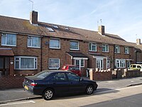
Bedhampton has a mixture of older houses, many (but not all) in what is known as Old Bedhampton;[1] post-war municipal housing at Stockheath; built in the late 1950s and 1960s at the southern end of the Leigh Park estate, a significant proportion of which is now privately owned; and a range of private housing, largely semi-detached.
There is a railway station here, with regular services to Portsmouth, Brighton, and London, and less frequent services to Southampton, Bristol, and Cardiff. The A27 and the A3(M) pass through the south-west part of Bedhampton.
History
Early mentions of Bedhampton are recorded in the ninth century, and the village is listed in the Domesday Book.[2]
Botanist Anne Brewis has commented on the different kinds of trees and flowers in the area.[3] The author of Jane's Fighting Ships, Fred T. Jane, lived in Bedhampton and founded the first Bedhampton Scout troop.[4]
Churches
- Church of England: St Thomas The Apostle
- Methodist
A church in Bedhampton is menationed in the Domesday Book of 1086.[5] The present parish church, St Thomas The Apostle,[6] in Old Bedhampton, dates from the 12th century.[7] In 1953 a church centre was built, and dedicated to St Nicholas.
The Methodist is a modern building in Hulbert Road replacing an earlier primitive chapel by the station, and a Gospel Hall, built between 1901 and 1922 with funds provided by local benefactor Miss Meiklam.
About the village
The Hermitage Stream Walk runs to the north of the parish, from New Road in the east to Purbrook Way in the west.
To the south of Bedhampton Road is Bidbury Mead, a large tree-ringed recreation ground – home to Bedhampton Mariners Cricket Club and Bedhampton Bowling Club. The locality borders onto Old Bedhampton, the area around St Thomas the Apostle parish church. The fourth, and least known,[8] space in Bedhampton is Scratchface Recreation Ground, situated to the west of the village within the parish boundary.
There is a community centre in Bedhampton village.
Outside links
| ("Wikimedia Commons" has material about Bedhampton) |
References
- ↑ The area from Kingscroft Lane to Mill Lane, around the parish church and up to Manor Farm
- ↑ Burrows, D.: 'A History of the Parish of Bedhampton' (1998)
- ↑ The Flora of Hampshire Anne Brewis et al. 1996. Harley Books. ISBN 0-946589-34-8.
- ↑ "The Centenary of Bedhampton Scouting" Neal,O Bedhampton, 1st Bedhampton Scout Troop, 2008
- ↑ A History of the County of Hampshire - Volume 3 pp 142-144: Parishes: Bedhampton (Victoria County History)
- ↑ Bedhampton Church
- ↑ Burrows, D.: 'A History of The Church of St Thomas The Apostle with St Nicholas Church Centre' (Bedhampton, St Thomas Parish, 1998)
- ↑ Borough Council Open Spaces Overview
- Smith, M.: 'Bedhampton School Centenary History' (1968)
- Hind, R.W.: 'The Naval Camps of Bedhampton, Havant and Leigh Park' (2003) ISBN 0-9546160-0-6


