Difference between revisions of "Atrim"
From Wikishire
(Created page with "{{Infobox town |name=Atrim |county=Dorset |picture=View towards Atrim - geograph.org.uk - 377973.jpg |picture caption=View towards Atrim |os grid ref=SY450955 |latitude=50.756...") |
(No difference)
|
Latest revision as of 19:57, 13 May 2020
| Atrim | |
| Dorset | |
|---|---|
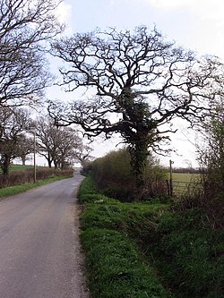
 View towards Atrim | |
| Location | |
| Grid reference: | SY450955 |
| Location: | 50°45’25"N, 2°46’49"W |
| Data | |
| Postcode: | DT6 |
| Local Government | |
| Council: | Dorset |
Atrim is a tiny hamlet in Dorset, just north of the large town, Bridport. It is situated on the River Simene. The nearest village is Dottery, closely followed by the larger village of Salway Ash.
Atrim is made up of a few houses. It is very near the route of the Monarch's Way long-distance walking trail.
Outside links
- Atrim in the Domesday Book