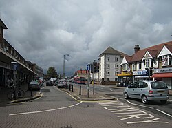
Ashford, Middlesex
| Ashford | |
| Middlesex | |
|---|---|
 Church Road, Ashford | |
| Location | |
| Grid reference: | TQ065715 |
| Location: | 51°25’57"N, 0°28’10"W |
| Data | |
| Population: | 25,240 |
| Post town: | Ashford |
| Postcode: | TW15 |
| Dialling code: | 01784 |
| Local Government | |
| Council: | Spelthorne |
| Parliamentary constituency: |
Spelthorne |
Ashford is a town in Middlesex; a fairly dull, suburban development in the west of the county in the last of the metropolitan conurbation and part of the London commuter belt.
Ashford stands in the angle between the A30 and A308 trunk roads which cross to the west of the town, at Staines. The River Ash runs under a roundabout at the far end of Fordbridge Road. The river appears to be named after the town, not the town from the river. For long a village, Ashford was always associated with Staines, its nearest neighbour.
Although the town's origins are ancient, Ashford's housing stock is chiefly a mixture of detached and semi-detached housing built between 1930 and 1960.
History
Ashford was most likely founded in Anglo-Saxon times, and has a name from the Old English language of the age, albeit one which means the same today as it did then: Ash (tree) ford. Mankind has dwelt here before then though: Bronze Age artefacts have been found in Ashford.
Ashford is listed in the Domesday Book as Exeforde. The manor was held by Robert, Count of Mortain. Its Domesday Assets were: 1 plough, meadow for 1 plough. It was soon joined to the Count’s manor of Kempton.
Churches
The present parish church of St Matthew was built in 1858 with financial assistance from the Welsh School (latterly St David's School, now St James School) which had just moved to Ashford. A daughter church to St Matthew was built on the corner of Stanwell Road and Woodthorpe Road, begun in 1913, in order to serve the needs of the rapidly growing community of dwellings built around the railway station.
Although the original design of this new church included a magnificent spire which would have been one of the most significant landmarks in the area, this was never built. The church without its spire was completed in 1928 and consecrated to St Hilda. Initially assigned the status of a Conventional District under the Parish Church of St Matthew, St Hilda's Church is now a Parish in its own right.
Economy
The high street is called Church Road and it mainly comprises local businesses; the usual range of chain store and supermarkets, cafés and the like. On Church Road also is the Ashford Campus of Brooklands College, Ashford Library and a Second World War memorial.
Ashford has very low unemployment rates. A great deal of local employment is directly related to Heathrow Airport. BP International is another major employer. Many other Ashford folk work in London to the east or in the Thames Valley to the west.
Transport
Ashford is well served by the railway, its station standing on the Waterloo to Reading Line with services to Waterloo station in London and the other way to Windsor & Eton Riverside.[1] By road, Ashford sits on the A30 trunk road.
Sport
- Cricket: Ashford CC
- Football: Ashford Town FC
- Golf: Ashford Manor Golf Club; an average golf course despite being described as flat and fairly boring.
- Others include Hockey, Tennis, Table Tennis, Aikido, Karate, Acrobatic Gymnastics, Sailing and Bowls clubs.
Outside links
- Church of England:
- St Michael's Roman Catholic Church
- Ashford Town Football Club
- Ashford Campus of Brooklands College
- Stained Glass Windows at St. David's School Chapel Ashford
References
- ↑ "Station Facilities for Ashford (Surrey)". National Rail. http://www.nationalrail.co.uk/stations/afs/details.html. Retrieved 6 March 2012.