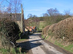
Acklam, East Riding
| Acklam | |
| Yorkshire East Riding | |
|---|---|
 Acklam | |
| Location | |
| Grid reference: | SE784617 |
| Location: | 54°2’43"N, 0°48’14"W |
| Data | |
| Population: | 168 |
| Post town: | Malton |
| Postcode: | YO17 |
| Local Government | |
| Council: | Ryedale |
| Parliamentary constituency: |
Thirsk and Malton |
Acklam is a small village in the East Riding of Yorkshire, about twelve miles north-east of York city centre and six miles south of Malton.
Contents
History
Acklam appears in the Domesday Book as Aclum in the East Riding. The Lord of the manor in 1066 was named as Siward and the manor comprised four ploughlands with two Lord's plough teams and a church.[1] The village lay within the ancient Wapentake of Buckrose
The etymology of the name is derived from Old English ac (oak) and leah (meadow or clearing).[2]
There are the remains of an earthwork motte and bailey castle on a ridge overlooking the village to the south.[3]
Church
There is a church in the village dedicated to St John the Baptist. It is part of the united Parish of West Buckrose in the Deanery of Southern Ryedale along with eight other churches.[4] The church is housed in what used to be the Wesleyan Methodist Chapel, built in 1794 after the Anglican Church was demolished.[5]
Outside links
| ("Wikimedia Commons" has material about Acklam, East Riding) |
References
- ↑ Acklam, East Riding in the Domesday Book
- ↑ Watts (2011). Cambridge Dictionary of English Place-names. Cambridge University Press. p. 2. ISBN 978-0521168557.
- ↑ National Heritage List 1008209: Motte and bailey castle south of Scotland
- ↑ "St John the Baptist". The Church of England. https://www.achurchnearyou.com/acklam-st-john-the-baptist/. Retrieved 10 December 2016.
- ↑ "Parish Church". http://www.westbuckrose.org/churches/acklam. Retrieved 10 December 2016.