File:Solway Firth map.png
From Wikishire
Size of this preview: 800 × 498 pixels. Other resolution: 320 × 199 pixels.
Original file (1,000 × 622 pixels, file size: 320 KB, MIME type: image/png)
Summary
| Description |
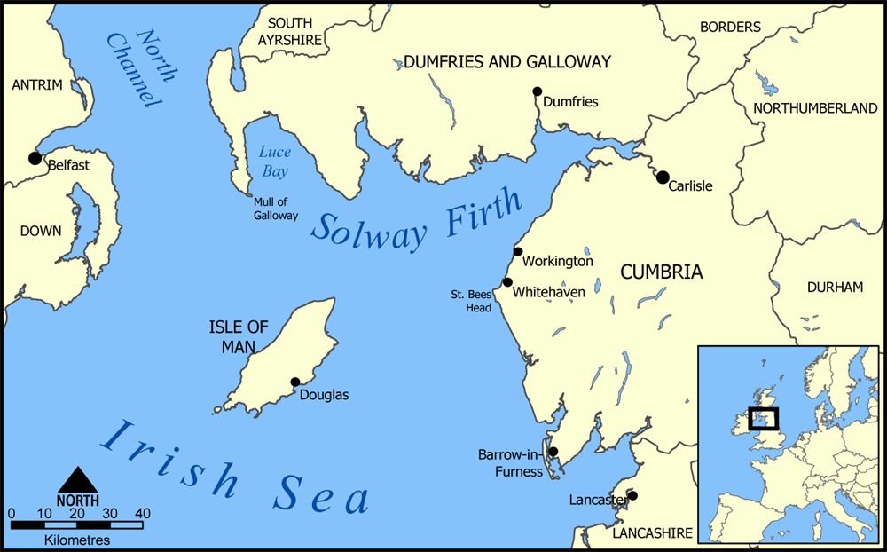
A map showing the location of Solway Firth between England and Scotland in the United Kingdom. Created by NormanEinstein, August 11, 2005. |
| Date | 11 August 2005 (original upload date) |
| Source | No machine-readable source provided. Own work assumed (based on copyright claims). |
| Author | No machine-readable author provided. NormanEinstein assumed (based on copyright claims). |
Licensing
I, the copyright holder of this work, hereby publish it under the following licenses:

|
Permission is granted to copy, distribute and/or modify this document under the terms of the GNU Free Documentation License, Version 1.2 or any later version published by the Free Software Foundation; with no Invariant Sections, no Front-Cover Texts, and no Back-Cover Texts. A copy of the license is included in the section entitled GNU Free Documentation License. |
| This file is licensed under the Creative Commons Attribution-Share Alike 3.0 Unported license. | ||
| ||
| This licensing tag was added to this file as part of the GFDL licensing update. |
You may select the license of your choice.
File history
Click on a date/time to view the file as it appeared at that time.
| Date/Time | Thumbnail | Dimensions | User | Comment | |
|---|---|---|---|---|---|
| current | 20:27, 11 August 2005 | | 1,000 × 622 (320 KB) | NormanEinstein | A map showing the location of Solway Firth between England and Scotland in the United Kingdom. Created by NormanEinstein, August 11, 2005. {{GFDL-self}} Category:Maps of the United Kingdom |
File usage
The following file is a duplicate of this file (more details):
- File:Solway Firth map.png from a shared repository
There are no pages that link to this file.