File:Rugged-Island-location-map.png
From Wikishire

Size of this preview: 800 × 548 pixels. Other resolution: 320 × 219 pixels.
Original file (1,669 × 1,144 pixels, file size: 152 KB, MIME type: image/png)
Summary
| Description |
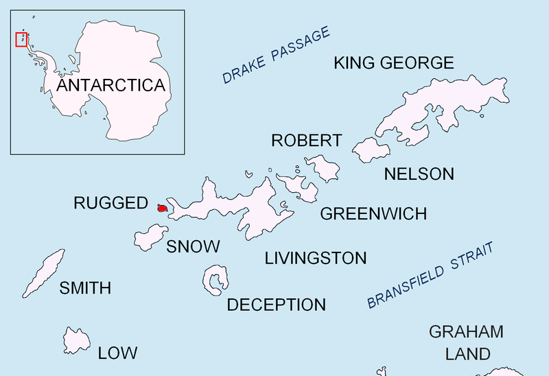
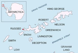
English: Location map of Rugged Island in the South Shetland Islands. |
| Date | |
| Source | Own work |
| Author | Apcbg |
Licensing
I, the copyright holder of this work, hereby publish it under the following licenses:
This file is licensed under the Creative Commons Attribution-Share Alike 3.0 Unported license.
- You are free:
- to share – to copy, distribute and transmit the work
- to remix – to adapt the work
- Under the following conditions:
- attribution – You must give appropriate credit, provide a link to the license, and indicate if changes were made. You may do so in any reasonable manner, but not in any way that suggests the licensor endorses you or your use.
- share alike – If you remix, transform, or build upon the material, you must distribute your contributions under the same or compatible license as the original.

|
Permission is granted to copy, distribute and/or modify this document under the terms of the GNU Free Documentation License, Version 1.2 or any later version published by the Free Software Foundation; with no Invariant Sections, no Front-Cover Texts, and no Back-Cover Texts. A copy of the license is included in the section entitled GNU Free Documentation License. |
You may select the license of your choice.
File history
Click on a date/time to view the file as it appeared at that time.
| Date/Time | Thumbnail | Dimensions | User | Comment | |
|---|---|---|---|---|---|
| current | 17:41, 24 August 2010 | | 1,669 × 1,144 (152 KB) | Apcbg | + location in Antarctica |
File usage
The following file is a duplicate of this file (more details):
- File:Rugged-Island-location-map.png from a shared repository
There are no pages that link to this file.