File:Loch Lomond Map c 1800.jpg
From Wikishire
Size of this preview: 427 × 599 pixels. Other resolution: 171 × 240 pixels.
Original file (3,616 × 5,072 pixels, file size: 3.82 MB, MIME type: image/jpeg)
Summary
| Description |
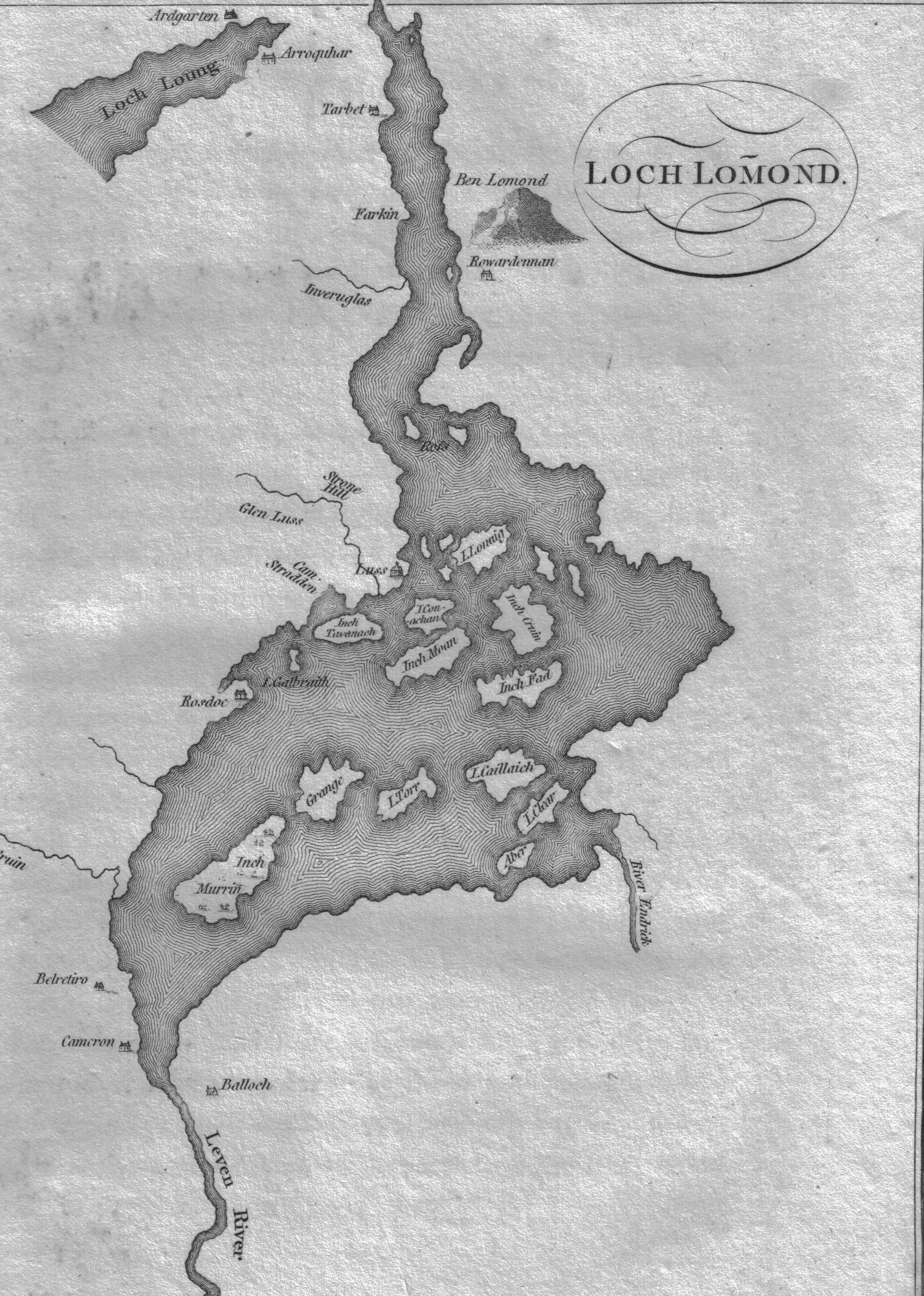
English: A map of Loch Lomond showing the islands and rivers. Circa 1800. Scotland. |
| Date | 14 June 2009 (upload date) |
| Source |
Garnetts Tour of Scotland. 1800. Presence suggested by Google books |
| Author | Roger Griffith |
Licensing
|
This work is in the public domain in its country of origin and other countries and areas where the copyright term is the author's life plus 70 years or fewer. | |
| This file has been identified as being free of known restrictions under copyright law, including all related and neighboring rights. | |
This file was reviewed on 29 April 2010 by the administrator or trusted user Rambo's Revenge (en.wiki), who confirmed the Public Domain status on that date.
|
File history
Click on a date/time to view the file as it appeared at that time.
| Date/Time | Thumbnail | Dimensions | User | Comment | |
|---|---|---|---|---|---|
| current | 18:02, 15 June 2009 | | 3,616 × 5,072 (3.82 MB) | Rosser1954 | {{Information |Description={{en|1=A map of Loch Lomond showing the islands and rivers. Circa 1800. Scotland.}} |Source=Garnetts Tour of Scotland. 1800. |Author=Roger Griffith |Date=2009/06/14 |Permission= |other_versions= }} <!--{{ImageUpload|full}}--> [ |
File usage
The following file is a duplicate of this file (more details):
- File:Loch Lomond Map c 1800.jpg from a shared repository
The following 2 pages link to this file: