File:Antarctica (4), Adelaide Island, Stonehouse Bay.JPG
From Wikishire
Size of this preview: 800 × 531 pixels. Other resolution: 320 × 213 pixels.
Original file (1,716 × 1,140 pixels, file size: 449 KB, MIME type: image/jpeg)
,_Adelaide_Island,_Stonehouse_Bay.JPG)
Summary
| Description |
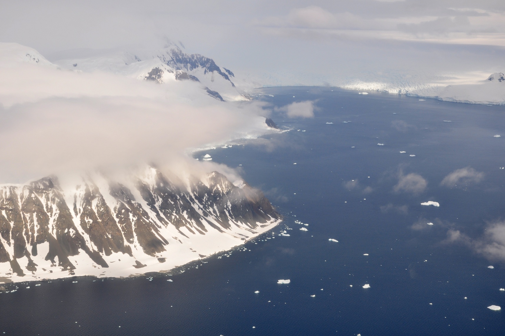
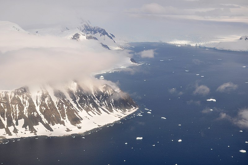
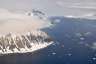
English: This picture is from the SW Antarctic Peninsula region.
It's an aerial view, looking West, from a position over Laubeuf Fjord to a part of Adelaide Island's east coast. In the foreground on the left is Sighing Peak, which forms the NE extremity of Adelaide Island's Wright Peninsula. The mountains behind it are the Stokes Peaks. The channel in front of Sighing Peak is called Cole Channel (and is actually a part of Laubeuf Fjord). The large body of water on the right is Stonehouse Bay. In the upper right hand corner of the picture, at the western end of Stonehouse Bay, is the huge and heavily crevassed Shambles Glacier; Adelaide Island's largest glacier. To the right of the glacier, at the extreme edge of the picture, is Dewar Nunatak. |
| Date | |
| Source | Own work |
| Author | Vincent van Zeijst |
•
| Camera location | | View this and other nearby images on: OpenStreetMap |
|---|
,_Adelaide_Island,_Stonehouse_Bay.JPG¶ms=-67.398517_N_-067.872161_E_globe:Earth_type:camera_heading:270.00&language=en)
Licensing
I, the copyright holder of this work, hereby publish it under the following license:
This file is licensed under the Creative Commons Attribution-Share Alike 3.0 Unported license.
- You are free:
- to share – to copy, distribute and transmit the work
- to remix – to adapt the work
- Under the following conditions:
- attribution – You must give appropriate credit, provide a link to the license, and indicate if changes were made. You may do so in any reasonable manner, but not in any way that suggests the licensor endorses you or your use.
- share alike – If you remix, transform, or build upon the material, you must distribute your contributions under the same or compatible license as the original.
File history
Click on a date/time to view the file as it appeared at that time.
| Date/Time | Thumbnail | Dimensions | User | Comment | |
|---|---|---|---|---|---|
| current | 22:29, 10 March 2011 | | 1,716 × 1,140 (449 KB) | Loranchet | {{Information |Description ={{en|1=This picture is from the SW Antarctic Peninsula region. It's an aerial view, looking West, from a position over Laubeuf Fjord to a part of Adelaide Island's east coast. In the foreground on the left is Sighing Peak, w |
File usage
The following file is a duplicate of this file (more details):
,_Adelaide_Island,_Stonehouse_Bay.JPG)
- File:Antarctica (4), Adelaide Island, Stonehouse Bay.JPG from a shared repository
The following 3 pages link to this file:
,_Adelaide_Island,_Stonehouse_Bay.JPG)
,_Adelaide_Island,_Stonehouse_Bay.JPG)
,_Adelaide_Island,_Stonehouse_Bay.JPG&action=edit&redlink=1)
,_Adelaide_Island,_Stonehouse_Bay.JPG)
,_Adelaide_Island,_Stonehouse_Bay.JPG&action=info)