Stob Bàn, Grey Corries
| Stob Bàn | |||
| Inverness-shire | |||
|---|---|---|---|
 Stob Bàn from the slopes of Stob Choire Claurigh | |||
| Range: | Grey Corries | ||
| Summit: | 3,205 feet NN266723 56°48’36"N, 4°50’26"W | ||
Stob Ban is a mountain amongst the Grey Corries of Inverness-shire. It reaches a height of 3,205 feet at its summit, and so it qualifies as a Munro. It stands 10 miles east of Fort William.
The mountain’s name is Gaelic for “White Peak”, appropriately as with the hill being covered in light coloured schist scree, in contrast to the rest of the Grey Corries which are made up of grey quartzite scree.[1] Not far to the south is an identically named mountain, Stob Bàn in the Mamores.

The mountain is a prominent conical shape, isolated from the rest of the group and distant from any main roads.
Stob Bàn lies south of the main Grey Corries ridge, connected to it and the highest mountain of the group, Stob Choire Claurigh, by an unnamed col]] with a height of 2,620 feet, this col has a small lochan also unnamed lying within it.
Stob Bàn’s conical shape is formed by three distinct ridges. The north eastern ridge drops to the valley of the Allt na Lairige which flows southerly into Loch Treig. The south-western ridge is gentle in gradient dropping down to a col at 2,460 feet before rising to the subsidiary summit of Meall a' Bhuirich (2,759 feet) which stands a mile and a half from the main summit.
The northern ridge is steep and connects to the Munro of Stob Choire Claurigh with rough scree underfoot with some care needed by walkers traversing between the two mountains.
Stob Bàn’s north-eastern face is precipitous and craggy and drops steeply to the valley of the Allt na Lairige.
One unusual characteristic of Stob Bàn is the so-called "Giants Staircase",[2] this is a 200-yard stretch of quartzite slabs encountered when descending from the 2,625-foot col between Stob Bàn and Stob Choire Claurigh to the Lairig Leacach. The staircase is awkward to negotiate especially in wet conditions.
Ascents
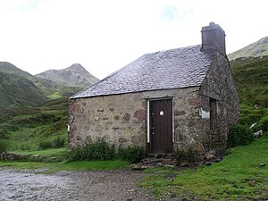
The direct ascent of Stob Bàn is usually undertaken from Corrie Choille farm in Glen Spean[3]" at grid reference NN251807. Going south, following the old Drovers' road between Glen Spean and Loch Treig, going over the pass of the Lairig Leacach and dropping down to the Lairig Leacach bothy. From here strike up the hillside to reach the east ridge which leads to the summit.
Stob Bàn is often climbed in conjunction with some or all of the Grey Corries Munros, this walk also starts from Corrie Choille farm. The view from the summit is very good with the Mamores and the hills around Loch Treig looking fine.
References
- The Munros, Scottish Mountaineering Trust, 1986, Donald Bennett (Editor) ISBN 0-907521-13-4
- In the Hills of Breadalbane, V.A. Firsoff, no ISBN
- The Munros, Scotland's Highest Mountains, Cameron McNeish, ISBN 1-84204-082-0
- The Magic Of The Munros, Irvine Butterfield, ISBN 0-7153-2168-4
- Hamish's Mountain Walk, Hamish Brown, ISBN 1-898573-08-5
- ↑ "The Munros" Page 77 ("it is not included in the quartzite covering .. but lies within a band of schist.).
- ↑ walking.visitscotland.com. Reference to Giants Staircase.
- ↑ "The Munros" Page 77 (Gives this route of ascent).
| Munros in SMC Area SMC Section 4 - Loch Linnhe to Loch Ericht |
|---|
|
Am Bodach • An Gearanach • Aonach Beag (Alder) • Aonach Beag (Nevis) • Aonach Mor • Beinn a' Chlachair • Beinn Bheoil • Beinn Eibhinn • Beinn na Lap • Ben Alder • Ben Nevis • Binnein Beag • Binnein Mòr • Càrn Dearg (Alder) • Càrn Dearg (Loch Ossian) • Càrn Mòr Dearg • Chno Dearg • Creag Pitridh • Geal Charn • Geal Charn, Ardverekie • Mullach nan Coirean • Na Gruagaichean • Sgor Gaibhre • Sgurr a' Mhàim • Sgùrr Choinnich Mòr • Sgùrr Eilde Mòr • Stob a' Choire Mheadhoin • Stob Bàn, Grey Corries • Stob Bàn, Mamores • Stob Choire Claurigh • Stob Coire a' Chairn • Stob Coire an Laoigh • Stob Coire Easain • Stob Coire Sgriodain |