Stob Coire Easain
| Stob Coire Easain | |
| Inverness-shire | |
|---|---|
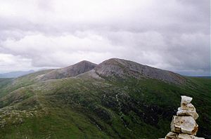
 Stob Coire Easain in front, Stob a' Choire Mheadhoin behind | |
| Summit: | 3,658 feet NN308730 56°49’4"N, 4°46’21"W |
Stob Coire Easain is a mountain in Inverness-shire, which reaches a height of 3,658 feet at its summit, and so it qualifies as a Munro. Its name, Stob Coire Easain', is from the Gaelic meaning "Peak of the Corrie of the Little Waterfall".
This mountain is found 11 miles east of Fort William, on the western side of Loch Treig, along with its "twin", the Munro Stob a' Choire Mheadhoin (3,625 feet). Collectively the pair are called "The Easains" or the "Stob Corries"[1] and stand less than a mile apart, connected by a high col with an approximate height of 3,166 feet.
Geography
The fine corrie of Coire Easain Beag lies in between the two mountains facing north-west.
The Easains stand in splendid isolation, hemmed in by valleys on three sides, giving Stob Coire Easain a substantial topographic prominence of 2,005 feet. It is the highest point on a five-mile long ridge which runs the entire length of the western side of Loch Treig; the eastern side of this ridge drops very steeply to the waters of the loch.
To the west of the mountain is the valley of the Allt na Lairig. A subsidiary ridge going north from the summit is initially steep and craggy as it descends to the head of Coire Laire. To the south of the summit the main ridge descends gently over Irlick Chaoile to the lonely country at the head of Loch Treig.
Ascents
Because of their close proximity, the Easains are usually climbed together with the best starting point being at the hamlet of Fersit (NN350784) where there is room to park a number of cars on the verges.
The north-east ridge of Stob a' Choire Mheadhoin is followed to the summit; it is then a steep descent and climb across the stony col to the summit of Stob Coire Easain. An alternative walk utilises the West Highland Line, with the walker starting at Corrour railway station and traversing round the head of Loch Treig to gain the main ridge of the Easains, which can then be crossed south to north finishing at Fersit.[2] Stob Coire Easain's height and isolation give good views with the vista west over the Grey Corries and the Aonachs towards Ben Nevis being especially fine.
References
- The Munros, Scottish Mountaineering Trust, 1986, Donald Bennett (Editor) ISBN 0-907521-13-4
- In the Hills of Breadalbane, V.A. Firsoff, no ISBN
- The Munros, Scotland's Highest Mountains, Cameron McNeish, ISBN 1-84204-082-0
- The Magic Of The Munros, Irvine Butterfield, ISBN 0-7153-2168-4
- Hamish's Mountain Walk, Hamish Brown, ISBN 1-898573-08-5
| Munros in SMC Area SMC Section 4 - Loch Linnhe to Loch Ericht |
|---|
|
Am Bodach • An Gearanach • Aonach Beag (Alder) • Aonach Beag (Nevis) • Aonach Mor • Beinn a' Chlachair • Beinn Bheoil • Beinn Eibhinn • Beinn na Lap • Ben Alder • Ben Nevis • Binnein Beag • Binnein Mòr • Càrn Dearg (Alder) • Càrn Dearg (Loch Ossian) • Càrn Mòr Dearg • Chno Dearg • Creag Pitridh • Geal Charn • Geal Charn, Ardverekie • Mullach nan Coirean • Na Gruagaichean • Sgor Gaibhre • Sgurr a' Mhàim • Sgùrr Choinnich Mòr • Sgùrr Eilde Mòr • Stob a' Choire Mheadhoin • Stob Bàn, Grey Corries • Stob Bàn, Mamores • Stob Choire Claurigh • Stob Coire a' Chairn • Stob Coire an Laoigh • Stob Coire Easain • Stob Coire Sgriodain |