North Beer
| North Beer | |
| Cornwall | |
|---|---|
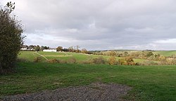
 North Beer from South Beer | |
| Location | |
| Grid reference: | SX307919 |
| Location: | 50°42’7"N, 4°24’0"W |
| Data | |
| Post town: | Launceston |
| Postcode: | PL15 |
| Local Government | |
| Council: | Cornwall |
North Beer is a hamlet in the parish of Boyton in northern Cornwall. North Beer is west of Boyton itself, in the Stratton Hundred of the county.[1]
References
- ↑ Philip's Street Atlas Cornwall. London: Philip's, 2003; p. 12

This Cornwall article is a stub: help to improve Wikishire by building it up.