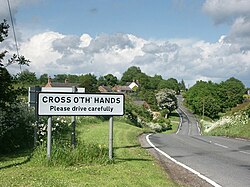
Cross o' th' Hands
| Cross o' th' Hands | |
| Derbyshire | |
|---|---|
 Cross o' th' Hands. | |
| Location | |
| Grid reference: | SK284464 |
| Location: | 53°-0’54"N, 1°34’41"W |
| Data | |
| Post town: | Belper |
| Postcode: | DE56 |
| Local Government | |
| Council: | Derbyshire Dales |
Cross o' th' Hands is a hamlet in Derbyshire, ten miles north-west of Derby on the A517 road between Hulland and Turnditch.
The hamlet is named after its original public house, near a gravel pit used for staging bare-knuckle fist fights, which was probably itself named after the sport.
The single road through Cross o' th' Hands, Intakes Lane, joins the A517 at the top of the hill, becoming Hillcliff Lane and joining up with the B5023 Wirksworth Road. The top of Hillcliff Lane has views across the open greenlands.