Luddington in the Brook
| Luddington in the Brook | |
| Northamptonshire, Huntingdonshire | |
|---|---|
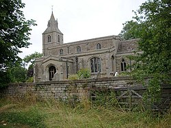
 Church of St Margaret | |
| Location | |
| Grid reference: | TL1083 |
| Location: | 52°26’19"N, 0°22’33"W |
| Data | |
| Post town: | Peterborough |
| Postcode: | PE8 |
| Dialling code: | 01832 |
| Local Government | |
| Council: | North Northamptonshire |
| Parliamentary constituency: |
Corby |
Luddington in the Brook is a village and ancient parish on the borders of Northamptonshire and Huntingdonshire. The name of its civil parish is Luddington. The population of the village is included in the civil parish of Hemington.
The county border cuts the parish into three pieces: The northernmost part lies in Northamptonshire and contains the village and parish church. The central section in Huntingdonshire contains Luddington Lodge and Luddington Lodge Farm. The final part in Northamptonshire lies to the south-west of the Thurning Road and comprises just empty fields.
St Margaret's Church, a Gothic Revival building designed by Richard Carpenter, is a Grade-II listed building.[1]
References
- ↑ National Heritage List 1040228: Church of St Margaret

This Northamptonshire article is a stub: help to improve Wikishire by building it up.