Wootton Courtenay
| Wootton Courtenay | |
| Somerset | |
|---|---|
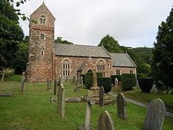
 Church of All Saints, Wootton Courtenay | |
| Location | |
| Grid reference: | SS938432 |
| Location: | 51°10’43"N, 3°31’10"W |
| Data | |
| Population: | 264 (2011) |
| Post town: | Minehead |
| Postcode: | TA24 |
| Dialling code: | 01643 |
| Local Government | |
| Council: | Somerset West and Taunton |
| Parliamentary constituency: |
Bridgwater & W. Somerset |
Wootton Courtenay is a village on Exmoor in Somerset. The parish includes the village of Huntscott.
The village lies on the route of the Macmillan Way West and the Celtic Way Exmoor Option.
Parish church
The Church of All Saints dates from the 13th century and is a Grade I listed building.[1]
Outside links
| ("Wikimedia Commons" has material about Wootton Courtenay) |
References
- ↑ National Heritage List 1345750: Church of All Saints
