Bengrove
| Bengrove | |
| Gloucestershire | |
|---|---|
 Bengrove | |
| Location | |
| Grid reference: | SO9732 |
| Location: | 51°59’32"N, 2°2’27"W |
| Data | |
| Local Government | |
| Parliamentary constituency: |
Tewkesbury |
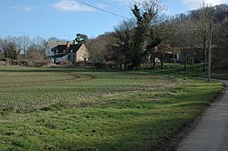
Bengrove is a tiny hamlet in Gloucestershire, found between Teddington and Alstone.
Teddington, just a few hundred yards west from Bengrove, is in a long, thin finger of Worcestershire, and Alstone in a detached part of that county locally situate in Gloucestershire, but not Bengrove itself.
The hamlet belongs to the Parish of Teddington, which falls within the Diocese of Worcester.
Bengrove farmhouse was built in the early 18th century,[1] and Bangrove Farm in the 1660s.[2]
Outside links
| ("Wikimedia Commons" has material about Bengrove) |
References
- ↑ National Heritage List 1091673: Bengrove Farmhouse
- ↑ National Heritage List 1156065: Bangrove Farm
