Totnor
| Totnor | |
| Herefordshire | |
|---|---|
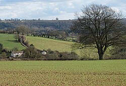
 Totnor, glimpsed form the Wye Valley Walk | |
| Location | |
| Grid reference: | SO598312 |
| Location: | 51°58’35"N, 2°35’17"W |
| Data | |
| Postcode: | HR1 |
| Local Government | |
| Council: | Herefordshire |
Totnor is a hamlet in Herefordshire in the parish of How Caple. It is in the valley of the River Wye, where the river describes a series of wild loops north of Ross-on-Wye
The hamlet lies on the route of the Wye Valley Walk.
Outside links
| ("Wikimedia Commons" has material about Totnor) |
