Upleadon
| Upleadon | |
| Gloucestershire | |
|---|---|
 St Mary the Virgin | |
| Location | |
| Grid reference: | SO7626 |
| Location: | 51°56’23"N, 2°21’26"W |
| Data | |
| Population: | 276 (2011[1]) |
| Post town: | Gloucester |
| Postcode: | GL18 |
| Local Government | |
| Council: | Forest of Dean |
| Parliamentary constituency: |
Forest of Dean |
Upleadon is a village and parish in the Botloe hundred of Gloucestershire, situated six miles north-west of Gloucester. Soon after the Norman conquest Upleadon became part of the estates of Gloucester Abbey and was recorded as such in the Domesday Book.[2] Taking advantage of the nearby river, there was a period when iron forges were a focal point for the community but these were subsequently converted into a flour-mill.[3] The village today extends southwards alongside the River Leadon and has a population of 213 according to Gloucestershire Council.[4]
Standing opposite the parish church, Upleadon Court is a large 18th-century farmhouse, but the asymmetry of its north front suggests that it was built around an older house. The lower timber-framed west wing was built in the late 16th or early 17th century.[5] Several outbuildings also predate the main house.
St Mary the Virgin, Parish Church
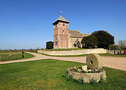
While there is evidence of much earlier worship on the site the current church is 11th-century in origin but has been heavily modified over the centuries. The Tudor-era tower is a rare, if not unique design as it is timbered from the base to its height and inlaid with red brick. The half-timbered main structure was added in the early 16th century and has a ‘wishbone’ type cross bracing. What used to be the Saxon-era East window now forms an arched entrance into the sanctuary. The nave and carved North doorway are both 12th-century Norman.
A rare Blackletter Bible printed in 1613 is on display in a case within the church. The interior is devoid of monuments and retains a simple decor throughout.[6]
St Mary The Virgin is a Grade-I listed for its architectural and historical significance.[7]
Carswalls Farm
Artist Paul Nash took a collection of photographs around Carswalls Farm, Upleadon, Newent in the late 1930s or early 1940s, that are held in the archives of the Tate.[8]
References
| ("Wikimedia Commons" has material about Upleadon) |
- ↑ "Parish population 2011". https://neighbourhood.statistics.gov.uk/dissemination/LeadKeyFigures.do?a=7&b=11129976&c=GL18+1EG&d=16&e=62&g=6427269&i=1001x1003x1032x1004&m=0&r=0&s=1427456546556&enc=1. Retrieved 27 March 2015.
- ↑ http://domesdaymap.co.uk/place/SO7626/upleadon/ Domesday Online - Upleadon
- ↑ The Comprehensive Gazetteer of England and Wales, 1894-5
- ↑ http://www.gloucestershire.gov.uk/inform/index.cfm?articleid=106330 GGC Population Estimates 2010
- ↑ http://www.victoriacountyhistory.ac.uk/sites/default/files/work-in-progress/Upleadon_photographs_6521.pdf VCH Archives
- ↑ Transactions - Bristol and Gloucestershire Archaeological Society (Volume 10)page 22 of 38
- ↑ National Heritage List 1153374: Upleadon
- ↑ Tate. "‘Black and white negative, fallen trees, Carswalls Farm’, Paul Nash, [c.1938-43 – Tate Archive"] (in en-GB). https://www.tate.org.uk/art/archive/items/tga-7050ph-1132/nash-black-and-white-negative-fallen-trees-carswalls-farm. Retrieved 2019-03-07.
Sources
1. David Verey - Gloucestershire 2, The Vale and The Forest of Dean, 1970 - Journal Title: The Buildings of England
