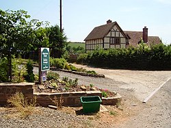
Whitton, Shropshire
| Whitton | |
| Shropshire | |
|---|---|
 House in Whitton | |
| Location | |
| Grid reference: | SO575725 |
| Location: | 52°20’56"N, 2°37’23"W |
| Data | |
| Population: | 239 (2011[1]) |
| Post town: | Ludlow |
| Postcode: | SY8 |
| Dialling code: | 01584 |
| Local Government | |
| Council: | Shropshire |
| Parliamentary constituency: |
Ludlow |
Whitton is a hamlet and civil parish in Shropshire. It originates as a township of the ancient parish of Burford.
It is situated east of Caynham and the market town of Ludlow is about five miles away. There is a parish church in the hamlet.[2]
Whitton Court is a Grade-I-listed manor house dating from 1611,[3] previously the home of Lord Mayor of London Sebastian Harvey, and members of the Charlton family.
References
- ↑ "Civil Parish population 2011". http://www.neighbourhood.statistics.gov.uk/dissemination/LeadKeyFigures.do?a=7&b=11130601&c=Whitton&d=16&e=62&g=6461048&i=1001x1003x1032x1004&m=0&r=1&s=1448550103312&enc=1. Retrieved 26 November 2015.
- ↑ Ordnance Survey mapping
- ↑ "Whitton Court". British Listed Buildings. http://www.britishlistedbuildings.co.uk/en-484023-whitton-court-whitton-.

This Shropshire article is a stub: help to improve Wikishire by building it up.