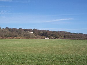
Betsom's Hill
| Betsom's Hill | |||
| Kent | |||
|---|---|---|---|

| |||
| Range: | North Downs | ||
| Summit: | 823 feet TQ43565633 51°17’17"N, -0°3’26"E | ||
Betsom's Hill is highest hill in Kent, rising to 823 feet. It is part of the Kentish North Downs, near the village of Westerham. The Pilgrim's Way path runs along the bottom of the hill.
The actual county top is reckoned at TQ4355556332, amongst the houses built on the old fort which crowns the hill. The hilltop is of Westerham Hill, the road between Westerham and Biggin Hill.
Westerham Fort or Betsom's Hill Fort was built in the nineteenth century as part of the defensive line strung along the North Downs as a defence against any invader, French or Prussian, who might cross the Channel. It was never used in anger of course and the fort has been demolished. The earthworks remain, and in their snug enclosure is a clutch of private houses.