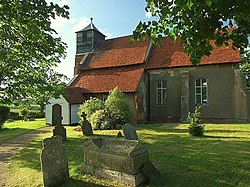
Buttsbury
| Buttsbury | |
| Essex | |
|---|---|
 St. Mary's church | |
| Location | |
| Grid reference: | TQ6698 |
| Location: | 51°39’42"N, -0°24’16"E |
| Data | |
| Local Government | |
| Council: | Chelmsford |
Buttsbury is a village and ancient parish in the Chelmsford hundred of Essex, on the river Wid. The civil parish was merged into that of Stock in 1936.[1] In 1931 the civil parish had a population of 1,709.[2].
It is located on minor roads between the towns of Ingatestone & Billericay.
References
- ↑ "Relationships and changes Buttsbury AP/CP through time". Vision of Britain. http://visionofbritain.org.uk/unit/10235777. Retrieved 30 January 2018.
- ↑ "Population Statistics Ridlington AP/CP through time". Vision of Britain. http://visionofbritain.org.uk/unit/10235777/cube/TOT_POP. Retrieved 30 January 2018.
| ("Wikimedia Commons" has material about Buttsbury) |
