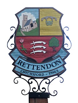
Rettendon
| Rettendon | |
| Essex | |
|---|---|
 Village sign | |
| Location | |
| Grid reference: | TQ765985 |
| Location: | 51°39’16"N, 0°32’59"E |
| Data | |
| Post town: | Chelmsford |
| Postcode: | CM3 |
| Dialling code: | 01268 |
| Local Government | |
| Council: | Chelmsford |
| Parliamentary constituency: |
Rayleigh |
Rettendon is a small village and parish in the Chelmsford hundred of Essex, about eight miles south-east of the city of Chelmsford. Situated near the River Crouch the village was once owned by the Bishop of Ely. The A130 road formerly passed through the village. There are a number of listed buildings in the parish.[1]
Education
Rettendon Primary School is located on the Main Road running through the village.
Hyde Hall
To the east of Rettendon, the garden at Hyde Hall was donated to the Royal Horticultural Society in 1993 and is open to the public.[2]
References
- ↑ Chelmsford City Council: "About listed buildings"
- ↑ History of Hyde Hall, Royal Horticultural Society, archived from the original on 11 March 2013, https://web.archive.org/web/20130311055521/http://www.rhs.org.uk/Gardens/Hyde-Hall/About-HydeHall/History, retrieved 15 March 2013
Outside links
| ("Wikimedia Commons" has material about Rettendon) |

This Essex article is a stub: help to improve Wikishire by building it up.
