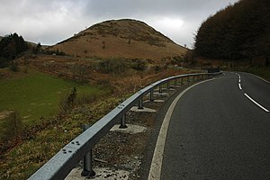
Sugar Loaf, Carmarthenshire
| Sugar Loaf | |
| Carmarthenshire | |
|---|---|

| |
| Summit: | 1,059 ft SN834427 52°4’16"N, 3°42’7"W |
Sugar Loaf, sometimes called The Sugar Loaf, is a prominence in Carmarthenshire beside the A483 trunk road some four miles south-west of Llanwrtyd Wells in neighbouring Brecknockshire. It is a popular viewpoint and picnic spot within easy reach on foot from the roadside car parks to the north-east and to the south. There is a stop on the nearby Heart of Wales railway line called Sugar Loaf just over the county border.
The name Sugar Loaf has been applied to numerous hills which have a perceived resemblance to a sugarloaf; the nearest is the Sugar Loaf, Monmouthshire close to the border with Brecknockshire.
Outside links
This Mountain or hill article is a stub: help to improve Wikishire by building it up.